
Pony Express National Historic Trail in Nebraska: Eighteen Months That Became a Legend
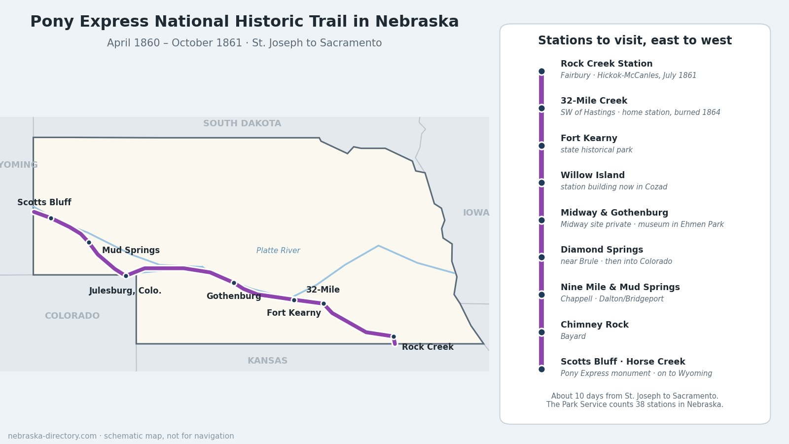
For about eighteen months in 1860 and 1861, young riders on fast horses carried the mail between St. Joseph, Missouri, and Sacramento, California, in about ten days. Nebraska held one of the longest stretches of the route. Riders came up from Kansas near Fairbury, followed the Little Blue River to Fort Kearny, galloped up the Platte past Gothenburg and North Platte, dipped into Colorado at Julesburg, and came back up Lodgepole Creek to the North Platte landmarks of the Panhandle. The road they used was the same one the Oregon and California emigrants had worn into the prairie.
Trail at a Glance
- In service: from April 3, 1860, to the fall of 1861. The transcontinental telegraph was finished on October 24, 1861; the Pony Express officially ended two days later, and the last riders finished their runs on November 20, 1861.
- Run by: Russell, Majors & Waddell, through their Central Overland California & Pike's Peak Express Company.
- Designated: a National Historic Trail on August 3, 1992 (Public Law 102-328).
- Length: about 2,000 miles across eight states, according to the National Park Service. The Park Service counts 441 miles of original route in Nebraska and 38 Nebraska stations; the stations grew from 86 on the first run to 147 by mid-1861 along the whole line.
- Counties: Jefferson, Thayer, Nuckolls, Clay, Adams, Kearney, Phelps, Dawson, Lincoln, Keith, Deuel, Cheyenne, Morrill and Scotts Bluff.
- Managed by: the National Park Service's National Trails Office, with states, landowners and partners. Most station sites are on private land and are marked by roadside signs rather than buildings.
The Route, East to West
The Little Blue Country
Riders entered Nebraska near Steele City at Rock House station and reached Rock Creek Station, east of Endicott, where the East Ranch served as a Pony Express station in 1860 and 1861. Next came Virginia City (also called Whiskey Run) and Big Sandy, near Alexandria. Along the Little Blue were Millersville, about 2 miles north of Hebron, Kiowa, Oak Grove, and Liberty Farm in Clay County, a homestead, station and road ranch later destroyed in the raids of 1864. Thirty-Two Mile Creek station, about 5 miles southwest of Hastings, was a home station built and owned by the company; it burned in August 1864. Sand Hill station stood south of Kenesaw.
Fort Kearny and the Platte
The road struck the Platte at Fort Kearny. Game and Parks says the fort served as a home station, while historians Merrill Mattes and Paul Henderson doubted the fort itself had one and pointed instead to nearby Kearney Station or the town of Dobytown. West along the south bank came Platt's station near Odessa, Garden, Plum Creek southeast of Lexington, and Willow Island southeast of Cozad. Midway station stood 3 miles south of Gothenburg. Then came Gilman's, Cottonwood Springs near the later Fort McPherson, Cold Springs, Fremont Springs south of Hershey, Dansey's, at O'Fallon's Bluff near Sutherland, Alkali Lake southwest of Paxton, Gill's south of Ogallala, and Diamond Springs near Brule.
Julesburg and Lodgepole Creek
West of Diamond Springs the route left Nebraska for two Colorado stations, Frontz's and Julesburg, then turned back north up Lodgepole Creek. Nine Mile station, also called Hughes' Ranch, stood near Chappell; it and Cold Springs were among the stations added on July 1, 1861. Two more Pole Creek stations followed before the trail swung north to the North Platte.
The North Platte Landmarks
Mud Springs, about 12 miles southeast of Bridgeport and north of Dalton, was a home station. Riders then passed Courthouse Rock and Chimney Rock, near Bayard, where the exact station site is uncertain. In Scotts Bluff County came Ficklin's Springs west of Melbeta, Scott's Bluff station near Mitchell, and Horse Creek, about 2 miles northeast of Lyman, the last stop before Wyoming.
Riders and Stories
- Jim Moore rode between Midway and Julesburg. On one ride he covered 280 miles in under 15 hours.
- William Campbell rode from Fort Kearny to Cottonwood Springs, changing horses at Plum Creek, Midway and Gilman's. Billy Campbell and Melville Baughn rode the Willow Island section.
- Other Nebraska riders included Henry Wallace (Big Sandy to Liberty Farm), Don C. Rising (Big Sandy to Fort Kearny) and Charles Cliff (Mud Springs to Scotts Bluff).
- Wild Bill Hickok worked at Rock Creek Station as a stock tender, not a rider. On July 12, 1861, he shot David McCanles there; accounts of what happened differ, and Hickok was acquitted on a claim of self-defense.
- Jack Slade was the company's division superintendent from Fort Kearny west into Wyoming. His feud with Jules Beni, founder of Julesburg, ended with Beni's death in August 1861. Accounts disagree about who killed him and where.
- Buffalo Bill Cody is often named as a Pony Express rider, but the Park Service says he never rode for it.
Places to Visit
- Rock Creek Station State Historical Park — 57426 710th Rd., Fairbury; 402-729-5777. Wagon ruts, rebuilt ranch buildings and a seasonal visitor center. Park entry permit required.
- Fort Kearny State Historical Park — 1020 V Rd., Kearney; 308-865-5305. The interpretive center is open May 1 through early October.
- Pony Express Station — Ehmen Park, 15th St. and Lake Ave., Gothenburg, 1 mile north of Interstate 80; 308-537-9876. Free, open April 3 to October 24. The cabin was moved here from the Upper 96 Ranch; some call it an original Pony Express station, while other researchers believe it was a trailside road ranch.
- Midway Station — 3 miles south of Gothenburg. Listed on the National Register of Historic Places in 1969; it stands on private land and is not open to the public.
- Willow Island Station — the relocated station building is in Veterans Memorial Park, 201 E. 9th St., Cozad.
- Dawson County Historical Society Museum — Lexington, for the history of the Plum Creek country.
- Thirty-Two Mile Station marker — South Osage Ave., about 5 miles southwest of Hastings. The station site itself is private.
- Mud Springs Station — about 1.5 miles west of U.S. 385, north of Dalton. A 48-acre archeological district owned by History Nebraska and listed on the National Register in 1973.
- Courthouse and Jail Rocks — Highway 88, about 5 miles south of Bridgeport.
- Chimney Rock National Historic Site — 9822 County Rd. 75, Bayard; 308-586-2581.
- Scotts Bluff National Monument — Gering; 308-436-9700. A Pony Express monument near the visitor center marks the 1960 centennial re-ride.
- Harold Warp Pioneer Village — Minden. Its cabin is sometimes called a Pony Express station, but Park Service researchers say it served the later Black Hills stage route.
Trail Cameras
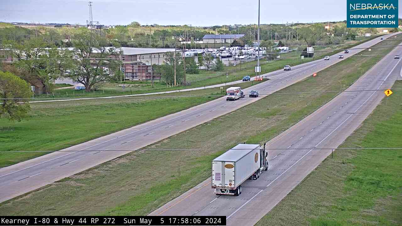
Live images from Nebraska 511 cameras along the Pony Express route, east to west. Click a picture for the full-size view. For every camera in the state, see Nebraska Cameras.
Driving the Trail Today
The Park Service's auto tour route enters on Highway 112, follows Highway 8 to Fairbury and U.S. 136 and state highways across the Little Blue country to U.S. 281, then U.S. 6/34, Highway 10 and U.S. 30 up the Platte to Big Springs. It dips to Julesburg on U.S. 138, comes north on U.S. 385, and follows Highway 92 through Gering and Scotts Bluff before leaving on U.S. 26. Roadside markers stand at Diamond Springs west of Brule, Big Springs, Nine Mile near Chappell, Cold Springs near North Platte, and the Scott's Bluff station site near Mitchell.
Every June the National Pony Express Association holds a ten-day Re-Ride, carrying mail the whole route as it has every year since 1978. The 2026 ride crossed Nebraska westbound June 16–18. The 2027 ride runs eastbound June 16–26, reaching the Wyoming–Nebraska line on June 23 and the Kansas line on June 25. Good places to watch include Rock Creek, Fort Kearny, Midway, Chimney Rock and Scotts Bluff.
Related Trails and Corridors
- Oregon National Historic Trail — the Pony Express used the Oregon Trail road across Nebraska
- California National Historic Trail
- Mormon Pioneer National Historic Trail
- Great Platte River Road
- Interstate 80, US Highway 30, US Highway 136 and Nebraska Highway 92
- ← All Nebraska Trails