
Richardson County Cameras
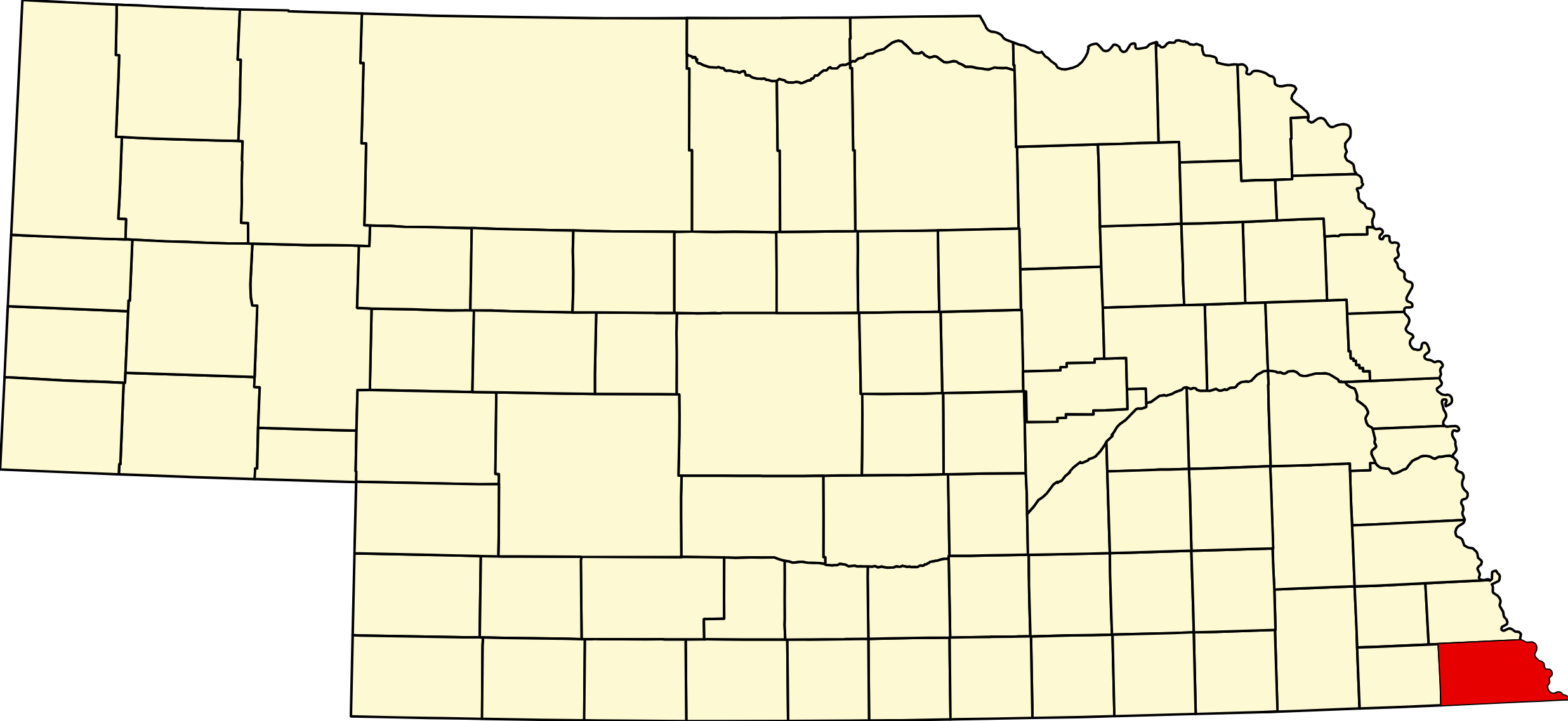
Richardson County, Nebraska
County seat: Falls City · Created: 1854; organized by the first territorial legislature in 1855 · Named for: William A. Richardson, the Illinois congressman who helped pass the Kansas–Nebraska Act and in 1858 became the third governor of Nebraska Territory · License plates: prefix 19 · Population: 7,871 (2020 census; peak 19,826 in 1930) · Area: 552 sq mi of land
About Richardson County
Richardson County is the southeastern corner of Nebraska, bounded by the Missouri River on the east and Kansas on the south and crossed by the Big Nemaha River, whose forks meet at Salem. Its northeast was part of the Nemaha Half-Breed Reservation created by an 1830 treaty, and the Sac and Fox and Iowa reservations still reach into the southeast around Preston and Rulo. Archer was named the first county seat in 1855, but an 1857 resurvey put it on reserved land; Salem held the seat briefly, and Falls City, founded in 1857 by free-state settlers, won it in 1860. River towns such as Arago, Rulo, Yankton and Winnebago grew up in the late 1850s.
The Atchison & Nebraska Railroad reached Falls City and Humboldt in 1871, and the Missouri Pacific built through Stella, Verdon and Falls City in 1881–82, while Arago faded. The county counted 19,826 people in 1930. Nebraska's first producing oil well was drilled near Falls City in 1939. An F4 tornado crossed the county in 1879, and Missouri River floods have closed the crossing at Rulo several times, most recently in 2019.
Towns of Richardson County
Cities and villages
Falls City
The Richardson County seat, a city of 4,133 near the Big Nemaha, founded in 1857 by free-state settlers. The 1925 courthouse and its military museum, the Falter museum, the Grand Weaver Hotel, Stanton Lake Park and the county hospital.
Humboldt
City of 800 around a brick-paved public square, laid out in 1868 and on the National Register as a historic district. HTRS schools, the Quad County Museum, Kirkman's Cove and the Richardson County Fair each September.
Dawson
Village of 148 on US 75 by the Big Nemaha, named for Joshua Dawson's 1867 mill. St. Mary's church, the Pennsylvania Colony museum north of town and the National Register Miles Ranch to the south.
Verdon
Village of 164 on US 73, platted in 1882 on the Missouri Pacific. Half a mile west, Verdon State Recreation Area has a spring-fed lake for fishing and 20 campsites.
Salem
One of Nebraska's oldest towns, settled in 1854 where the forks of the Big Nemaha meet, and county seat until Falls City won it in 1860. A village of 84 today.
Rulo
Missouri River village of 144 where US 159 crosses into Missouri, laid out in 1857 on land of the Rouleau family. Lewis and Clark camped near here in 1804; Immaculate Conception church and Wild Bill's on the river.
Shubert
Village of 163 platted in 1883 on the Burlington and named for orchardist Henry W. Shubert. Gateway and mailing address for Indian Cave State Park, about 6 miles northeast.
Stella
Village of 150 on NE 62, laid out in 1881 when the Missouri Pacific arrived and named for Stella Clark. The 1908 R. A. Clark House and Way Side Stock Farm are on the National Register.
Barada
Village of 20 in the Barada Hills near the Missouri, named for the legendary strongman Antoine Barada, buried just east of town. The 1881 Mount Zion Brick Church and Indian Cave State Park are nearby.
Preston
One of Nebraska's smallest villages, 19 people in 2020, inside the Sac and Fox Reservation east of Falls City. Platted on the Atchison & Nebraska line in 1878–81 and named for Preston, England.
Former towns and post office communities
Archer
First seat of Richardson County, laid out in 1855 by Muddy Creek and abandoned in 1857 when a resurvey put it on the Half-Breed Reservation. Only its cemetery remains.
Arago
German colony town of 1858 on the Missouri, incorporated in 1860 and once a busy river port with mills, a brewery and pork packing. St. Mary's church and the cemetery remain.
Winnebago
Small town of 1858 near the Missouri north of Rulo, laid out on Half-Breed Tract land of Joseph Piquoit and settled mostly by French and Native families.
Yankton
River town platted in 1857 on the Missouri just north of Rulo by the Yankton Town Company. Coal was found there, and its houses were later rebuilt as Falls City's first hotel.
Strausville
Small place north of Falls City, laid out on Gustave Strauss's land in 1901, with a post office from 1899 to 1912.
Nim City
Town platted in 1903 by Betsey U. Nims in hope of a railroad that never came; it had a hotel, stores and a hall about 1906–08. A few homes remain.
St. Stephens
Missouri River ferry town laid out in 1855 by Benjamin F. Loan and Stephen Story, briefly the largest town in the county. It was absorbed by Arago, a mile south.
Travel Corridors
US 75 — north–south through the west of the county and Dawson, from Kansas toward Auburn and Nebraska City. US 75 Corridor →
US 73 and US 159 — enter together from Kansas south of Falls City. US 159 turns east to Rulo and its 2013 bridge over the Missouri; US 73 runs north through Falls City and Verdon to its end at US 75 near Dawson.
State highways — NE 4 from Table Rock through Humboldt to US 75; NE 8 from Du Bois east to Falls City; NE 105 north through Humboldt toward Johnson; NE 62 from US 75 through Stella to Shubert; and NE 67 from US 73 near Verdon north past Shubert, with spur S-64E to Indian Cave State Park.
Cameras: View Richardson County cameras → · Road conditions: Nebraska 511
Things to See
In Falls City: the 1925 courthouse with the Military History Museum, the John Philip Falter Museum, the Richardson County Historical Museum, the Library & Arts Center, the Grand Weaver Hotel and the Stone Street historic district. In Humboldt: the historic public square and the Quad County Museum. North of Dawson: the Pennsylvania Colony museum. Near Barada: the Mount Zion Brick Church and Antoine Barada's grave. In Rulo: the Lewis and Clark campsite marker.
Outdoors
Indian Cave State Park, on the Missouri bluffs northeast of Shubert, has petroglyphs, about 38 miles of trails and two large campgrounds. Verdon State Recreation Area has a spring-fed fishing lake and 20 campsites, and the Nemaha NRD's Kirkman's Cove near Humboldt has a 160-acre lake, a beach, camping and the Kirkman's Lakeview Golf Course. Falls City's Stanton Lake Park and Humboldt Lake Park have RV sites. Hunters can use the Four-Mile Creek, Kinter's Ford, Margrave and South Fork wildlife management areas.
Richardson County Business Directory
Businesses within 20 miles of: Falls City · Humboldt · Dawson · Shubert · Rulo · All listings →
Adjacent Counties
Nemaha County (north) · Holt County, Missouri (east, across the Missouri) · Doniphan County, Kansas (southeast) · Brown County, Kansas (south) · Nemaha County, Kansas (southwest) · Pawnee County (west)
Events
2026 dates: the 4-H and FFA Junior Fair in Humboldt (July 19–25); the Richardson County Fair in Humboldt in mid-September (September 16–17 on the Extension calendar); Haunted Hollow at Indian Cave State Park (October 9–10, 17 and 24); and in Falls City the Fall Makers & Merchants Market (October 11), the Lighted Christmas Parade (November 27) and the Christmas Vendor Festival (November 28). The Falls City Hot Air Balloon Festival is held at Brenner Field each June.
Events in Richardson County
- Richardson County Fair (Humboldt)
Richardson County Fair, a county fair in Falls City, Nebraska.
Know of another event in the county? Tell us about it.
Richardson County Road Map
Download the printable county road map (PDF, Nebraska Dept. of Transportation)
Richardson County at a Glance
Richardson County, Nebraska — the state's southeastern corner, on the Missouri River and the Kansas line. County seat Falls City; the other city is Humboldt.
Getting there: US 75 from Auburn or Kansas, US 73 and US 159 from Kansas, and US 159 across the Missouri at Rulo.
For visitors: Falls City's museums and historic downtown, Humboldt's square, Indian Cave State Park, Verdon State Recreation Area, Kirkman's Cove and the county fair in Humboldt. Hospital: Community Medical Center in Falls City.
Vehicles registered in Richardson County carry license plate number 19. See what every Nebraska county number means.
Richardson County Businesses & Places
233 listings in Richardson County.
Click a category to see the businesses.
Eat & Drink (8)
- A&G Steakhouse and Pizza — American Restaurant, Falls City
- Frosty Queen — Diner / Family Restaurant, Falls City
- Great China Buffet — Chinese Restaurant, Falls City
- Runza Falls City — Runza, Falls City
- Six Mile Cafe — American Restaurant, Dawson
- Subway – 1423 Harlan Street, Falls City — Subway, Falls City
- Swingin' Doors — Bar & Grill, Nebraska
- Wild Bill's Bar & Grill — Bar & Grill, Nebraska
Stay (1)
- Grand Weaver Hotel — Hotel, Falls City
Outdoors & Recreation (12)
- Falls City Country Club — Country Club, Falls City
- Four-Mile Creek WMA — Public Hunting Areas & WMAs, Humboldt
- Humboldt Lake Park — Campgrounds & RV Parks, Humboldt
- Indian Cave State Park — Campgrounds & RV Parks, Nebraska
- Kinter's Ford WMA — Public Hunting Areas & WMAs, Humboldt
- Kirkman's Cove — Campgrounds & RV Parks, Humboldt
- Kirkman's Lakeview Golf Course — Golf Course, Humboldt
- Margrave WMA — Public Hunting Areas & WMAs, Nebraska
- South Fork WMA — Public Hunting Areas & WMAs, Dawson
- Stanton Lake Park — Campgrounds & RV Parks, Falls City
- Thomas C. Matter WMA — Public Hunting Areas & WMAs, Nebraska
- Verdon State Recreation Area — Campgrounds & RV Parks, Nebraska
Places to Visit (9)
- John Philip Falter Museum - Falls City — Specialty Museums, Falls City
- Lewis and Clark Campsite Marker — Historic Marker, Nebraska
- Mount Zion Brick Church — Attraction, Barada
- Nemaha River Falls Marker — Historic Marker, Falls City
- Quad County Historical & Research Society (Quad County Museum) — History & Heritage Museums, Humboldt
- Richardson County Military History Museum — Military Museums, Falls City
- Richardson County Museum — History & Heritage Museums, Falls City
- The Pennsylvania Colony of Nebraska Historical Society — History & Heritage Museums, Dawson
- Verdon State Recreation Area — State Recreation Areas, Nebraska
Events & Venues (2)
- Richardson County Fair — County Fair, Humboldt
- Richardson County Fairgrounds — Fairground, Humboldt
Health & Emergency (8)
- Animal Health Center — Mixed / General Practice, Falls City
- Community Medical Center, Inc. — Hospital, Falls City
- Falls City Family Practice — Medical Clinic, Falls City
- Humboldt Family Medicine — Medical Clinic, Humboldt
- Kex Rx Pharmacy & Home Care — Pharmacy, Falls City
- Kobza Dental PC — Dentist & Dental Office, Falls City
- McPeak Optometry — Optometrist, Falls City
- Miracle-Ear Hearing Aid Center - Falls City — Hearing Aids, Falls City
Shopping & Gifts (7)
- 159 Lumber — Hardware Store, Falls City
- Barada Hills Trading Co. — General Store, Nebraska
- Chaney's Furniture — Furniture, Falls City
- Corner Liquor — Liquor Store, Falls City
- Dollar Fresh — Grocery, Falls City
- Old Windmill Antiques — Antique Mall, Nebraska
- Prairie Sky Antiques & Vintage — Antique Mall, Falls City
Community & Faith (86)
- Amateur Radio Repeaters - Richardson County (via RepeaterBook.com) — Amateur Radio Repeater, Nebraska
- Anderson’s Cemetery — Falls City — Cemeteries, Falls City
- Arago Cemetery — Cemeteries, Arago
- Archer Cemetery — Cemeteries, Archer
- Athens Cemetery — Rulo — Cemeteries, Nebraska
- Berg Cemetery — Barada — Cemeteries, Barada
- Bratton Union Cemetery — Barada — Cemeteries, Nebraska
- Brick Church Cemetery — Barada — Cemeteries, Barada
- Christ Lutheran Church — Lutheran Church, Falls City
- Cupola Cemetery — Shubert — Cemeteries, Nebraska
- Czech (Bohemian) National Cemetery — Humboldt — Cemeteries, Humboldt
- Dry Branch Cemetery — Humboldt — Cemeteries, Humboldt
- Emmanuel Lutheran Cemetery — Salem — Cemeteries, Nebraska
- Faith Lutheran Church — Lutheran Church, Humboldt
- Falls City Catholic Cemetery — Falls City — Cemeteries, Falls City
- Falls City Cemetery — Falls City — Cemeteries, Falls City
- Falls City Church of Christ — Other Denomination, Falls City
- Falls City Church of the Nazarene — Other Denomination, Falls City
- Falls City First UMC — Methodist Church, Falls City
- Four Mile Cemetery — Rulo — Cemeteries, Nebraska
- Franklin Cemetery — Rulo — Cemeteries, Nebraska
- Fricke Cemetery — Falls City — Cemeteries, Falls City
- Gird Family Cemetery — Falls City — Cemeteries, Falls City
- Good News Assembly of God — Pentecostal, Falls City
- Gravesite Of Cecilia Kunze — Humboldt — Cemeteries, Humboldt
- Harris Cemetery — Barada — Cemeteries, Barada
- Heater Cemetery — Rulo — Cemeteries, Nebraska
- Heim Cemetery — Dawson — Cemeteries, Dawson
- Herbster Cemetery — Falls City — Cemeteries, Falls City
- Huff Cemetery — Barada — Cemeteries, Barada
- Humboldt Cemetery — Humboldt — Cemeteries, Humboldt
- Humboldt, NE UMC — Methodist Church, Humboldt
- Iliff Cemetery — Dawson — Cemeteries, Dawson
- Immaculate Conception Cemetery — Rulo — Cemeteries, Nebraska
- Immaculate Conception Rulo — Catholic Church, Nebraska
- Jones Cemetery — Rulo — Cemeteries, Nebraska
- Kingdom Hall of Jehovah's Witnesses — Jehovah’s Witnesses Church, Falls City
- Liberty Cemetery — Verdon — Cemeteries, Nebraska
- Liberty-Cornell Cemetery — Verdon — Cemeteries, Nebraska
- Longbranch Cemetery — Humboldt — Cemeteries, Humboldt
- Lynchburg Cemetery — Humboldt — Cemeteries, Humboldt
- Maple Cemetery — Salem — Cemeteries, Nebraska
- Maple Grove Cemetery — Falls City — Cemeteries, Falls City
- Mound Cemetery — Humboldt — Cemeteries, Humboldt
- Mount Zion Cemetery — Humboldt — Cemeteries, Humboldt
- Nemaha Falls Cemetery — Falls City — Cemeteries, Falls City
- Partlow Cemetery — Rulo — Cemeteries, Nebraska
- Pearson’s Point Cemetery — Falls City — Cemeteries, Falls City
- Penuel Cemetery — Shubert — Cemeteries, Nebraska
- Pleasant Hill Cemetery — Humboldt — Cemeteries, Humboldt
- Pleasant View Cemetery — Humboldt — Cemeteries, Humboldt
- Poor Farm Cemetery — Falls City — Cemeteries, Falls City
- Prairie Union Cemetery — Shubert — Cemeteries, Nebraska
- Prospect Cemetery — Humboldt — Cemeteries, Humboldt
- Rock Creek Station Cemetery — Salem — Cemeteries, Nebraska
- Rulo Cemetery — Rulo — Cemeteries, Nebraska
- Silver Creek Cemetery — Falls City — Cemeteries, Falls City
- St. Ann's Catholic Cemetery — Shubert — Cemeteries, Nebraska
- St. Anne Catholic Church (Shubert) — Catholic Church, Nebraska
- St. DeRoin Cemetery — Barada — Cemeteries, Barada
Government & Resources (44)
- ACCESSNebraska Office - Falls City — Developmental & Social Services, Falls City
- Barada Village Office — City Hall, Barada
- Bruun Memorial Library - Humboldt — Libraries, Humboldt
- Colonial Acres Nursing Home — Assisted Living, Humboldt
- Dawson Post Office — Post Office, Dawson
- Dawson Village Office — City Hall, Dawson
- Eastview Apartments (Senior Meal Site) — Senior Citizen Center, Falls City
- Falls City Area Chamber of Commerce — Chamber of Commerce, Falls City
- Falls City Care Center — Assisted Living, Falls City
- Falls City Fire Department — Fire Station, Falls City
- Falls City Housing Authority — Housing Authority, Falls City
- Falls City Library & Arts Center — Libraries, Falls City
- Falls City Nursing & Rehab — Assisted Living, Falls City
- Falls City Police Department — Police Station, Falls City
- Falls City Post Office — Post Office, Falls City
- Falls City Senior Center — Senior Citizen Center, Falls City
- Falls City USDA Service Center — USDA Service Center (FSA/NRCS), Falls City
- Humboldt Chamber of Commerce — Chamber of Commerce, Humboldt
- Humboldt City Hall — City Hall, Humboldt
- Humboldt Fire Department — Fire Station, Humboldt
- Humboldt Housing Authority — Housing Authority, Humboldt
- Humboldt Post Office — Post Office, Humboldt
- John G Smith Memorial Library - Dawson — Libraries, Dawson
- Richardson County Assessor — County Assessor, Falls City
- Richardson County Attorney's Office — County Attorney, Falls City
- Richardson County Clerk — County Clerk, Falls City
- Richardson County Court — County Court, Falls City
- Richardson County Courthouse — Court House, Falls City
- Richardson County Driver License Office — County Driver License, Falls City
- Richardson County Emergency Management — Emergency Management, Falls City
- Richardson County Sheriff — County Sheriff, Falls City
- Richardson County Treasurer — County Treasurer, Falls City
- Richardson County Veterans Service Office — Veterans Office, Falls City
- Richardson County Weed Superintendent — County Weed Control, Falls City
- Rulo Post Office — Post Office, Nebraska
- Rulo Village Office — City Hall, Nebraska
- Salem Village Office — City Hall, Nebraska
- Shubert Public Library — Libraries, Nebraska
- Shubert Village Office — City Hall, Nebraska
- Stella Community Library — Libraries, Nebraska
- Stella Post Office — Post Office, Nebraska
- Stella Village Office — City Hall, Nebraska
- Verdon Post Office — Post Office, Nebraska
- Village of Verdon Library — Libraries, Nebraska
Utilities (12)
- City of Falls City — Water Utility / District, Falls City
- City of Humboldt — Water Utility / District, Humboldt
- Falls City Municipal Gas — Natural Gas Provider, Falls City
- Falls City Municipal Utilities — Electric Power Provider, Falls City
- Richardson County RWD 1 — Water Utility / District, Humboldt
- Richardson County RWD 2 — Water Utility / District, Falls City
- Village of Dawson — Water Utility / District, Dawson
- Village of Rulo — Water Utility / District, Nebraska
- Village of Salem — Water Utility / District, Nebraska
- Village of Shubert — Water Utility / District, Nebraska
- Village of Stella — Water Utility / District, Nebraska
- Village of Verdon — Water Utility / District, Nebraska
Automotive (10)
- Armbruster Motor Company — Franchised New Car Dealer, Falls City
- Casey's General Store - Falls City — Casey's, Falls City
- Falls City Auto Supply — Auto Parts, Falls City
- Harmon's OK Tire — Tire Shop, Falls City
- Hullmans Ford Lincoln — Franchised New Car Dealer, Falls City
- K & J Truck & Auto — Truck Dealership, Dawson
- Koch's Auto Services — Auto Repair, Dawson
- M & M Motorsports & Auto Sales — Motor Sports, Falls City
- Pump & Pantry - Falls City — Pump & Pantry, Falls City
- Sherman's Station — Auto Repair, Humboldt
Education (10)
- Falls City Middle School — Elementary & Middle School, Falls City
- Falls City North Elementary — Elementary & Middle School, Falls City
- Falls City Public Schools — School District (K-12 / General), Falls City
- Falls City Senior High — High School, Falls City
- Falls City South Elementary — Elementary & Middle School, Falls City
- HTRS Elementary School — Elementary & Middle School, Humboldt
- HTRS High School — High School, Humboldt
- Humboldt Table Rock Steinauer Public Schools — School District (K-12 / General), Humboldt
- Richardson County Extension — County Extension Office, Falls City
- Sacred Heart Catholic School Falls City — Faith-Based School, Falls City
Professional Services (8)
- American Family Insurance — Insurance, Falls City
- American National Bank - Falls City — Banking, Falls City
- Community Insurance Group – Humboldt — Insurance, Humboldt
- Equity Bank - Falls City — Banking, Falls City
- F&M Bank — Banking, Falls City
- Falls City Realty PC — Real Estate Agency, Falls City
- First Interstate Bank - Falls City — Banking, Falls City
- Halbert, Dunn & Burns, LLC — Attorney, Falls City
Media (6)
- Falls City Journal — News Paper, Falls City
- Humboldt Standard — News Paper, Humboldt
- K25OG-D Channel 12 - Falls City — TV Translator, Falls City
- KLZA 101.3 FM - Falls City — Radio Station, Falls City
- KTNC 1230 AM - Falls City — Radio Station, Falls City
- My Bridge Radio 91.7 FM - Shubert — My Bridge Radio, Nebraska
Transportation (3)
- Brenner Field — Falls City — Municipal / General Aviation Airport, Falls City
- Richardson County Transit System — Public Transportation, Falls City
- Southeast Nebraska Community Action (SENCA) — Public Transportation, Humboldt
Agriculture & Farm (3)
- Bruna Brothers Implement — Equipment Dealers, Humboldt
- Herbster Angus Farms — Cattle / Beef, Falls City
- True Ag & Turf – Falls City — Equipment Dealers, Falls City
Personal Services (2)
- Dorr & Clark Funeral Home — Funeral Home, Falls City
- Hall Funeral Home — Funeral Home, Falls City
Manufacturing & Industrial (1)
- Airlanco — General / Custom Manufacturing, Falls City
Trades & Construction (1)
- Airstream Heating & Cooling — HVAC Contractor, Falls City
Land & Property Services (1)
- TCK Stutheit LLC DBA Stutheit Service — Land Clearing & Brush Removal, Humboldt