
Kimball County Cameras
Kimball County Cameras
Kimball County Cameras
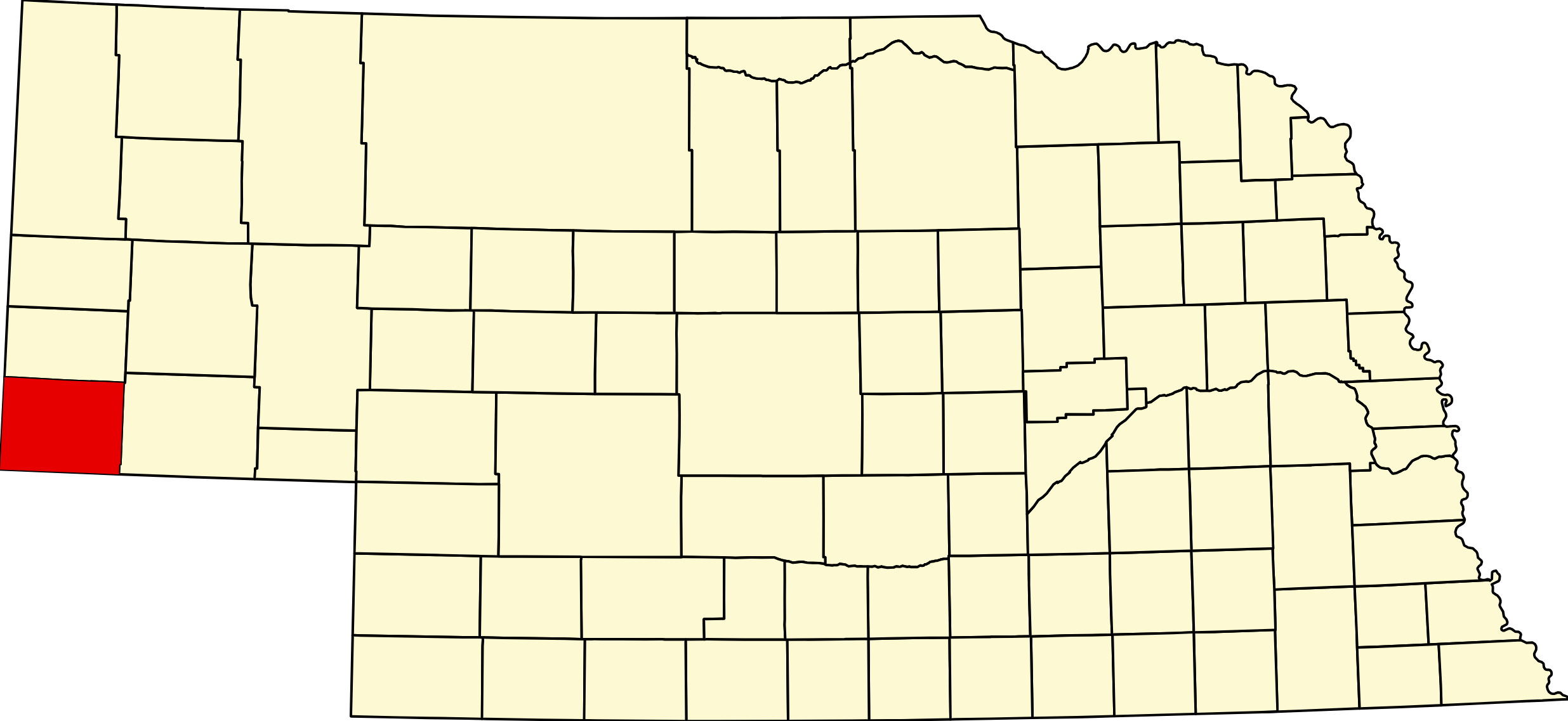
Kimball County, Nebraska
County Seat: Kimball
Founded: 1888
Named For: Thomas L. Kimball, Union Pacific Railroad official
License Plate Prefix: 71
Population: 3,434 (2020 census)
Area: 952 sq mi
History
Kimball County was created in 1888 from part of Cheyenne County and named after Thomas L. Kimball, a prominent Union Pacific Railroad executive. The county seat, Kimball, developed as a key railroad and agricultural service center on the High Plains. The region’s early history is tied to ranching, dryland farming, and the growth of small prairie communities.
During the Cold War, Kimball County became home to several missile sites associated with the Air Force’s strategic deterrence program, adding a unique chapter to its history. Agriculture, energy development, and transportation continue to shape the county’s identity.
Geography
Location: Southern Nebraska Panhandle along the Colorado and Wyoming borders
Landscape: High Plains grasslands, rolling hills, canyons, and agricultural land
Adjacent Counties:
- Banner County (north)
- Cheyenne County (east)
- Laramie County, Wyoming (west)
- Logan County, Colorado (south)
- Sedgwick County, Colorado (southeast)
Culture & Landmarks
- Panorama Point – Highest natural point in Nebraska at 5,429 feet, located near the tri‑state area.
- Kimball Plains Historical Museum – Exhibits on pioneer life, agriculture, and local heritage.
- Cold War Missile Sites – Former Air Force installations that highlight the region’s strategic history.
Notable Communities
- Kimball – County seat and largest community.
- Bushnell – Small village near the Wyoming border.
- Dix – Rural community with strong agricultural roots.
Events & Attractions
- Kimball County Fair – Livestock shows, rodeo events, and community celebrations.
- Panorama Point Visits – A popular destination for travelers seeking Nebraska’s highest elevation.
- Outdoor Recreation – Hunting, hiking, and prairie exploration across the High Plains.
Living in Kimball County
Kimball County offers a quiet rural lifestyle with strong ties to agriculture, energy development, and open‑land recreation. Kimball provides essential services, schools, and businesses, while surrounding communities maintain deep ranching and farming traditions. Residents value the area’s peaceful pace, wide‑open landscapes, and unique blend of frontier and Cold War history.
Kimball County Road Map
Download the printable county road map (PDF, Nebraska Dept. of Transportation)
Kimball County Road Map
Download the printable county road map (PDF, Nebraska Dept. of Transportation)
Outdoors — Camping, RV, Hunting & Fishing
Kimball County holds the highest ground in Nebraska and the best free camping on the interstate tier — but almost no public land otherwise.
Panorama Point — the highest natural point in Nebraska. Southwestern Kimball County, near the Nebraska–Wyoming–Colorado tri-state corner, whose marker is visible nearby. The stone summit marker reads 5,424 feet; the modern survey figure is 5,429 feet. Both numbers are in circulation and both are defensible.
Two things visitors need to know. It is on private land — the High Point Bison Ranch. You may drive to the site, but there is an entrance fee and there are free-ranging bison to keep clear of. It is not a public park and should never be treated as one. And it is not a mountain or even a hill — it is a low rise on the High Plains with a stone marker and a guest register. On a clear day the Rockies are visible west.
A related correction: Kimball is not Nebraska’s highest town. That is Harrison in Sioux County at 4,876 feet. Kimball’s “High Point of Nebraska” slogan refers to Panorama Point, thirty-some miles away.
Oliver Reservoir. Eight miles west of Kimball on US-30, on Lodgepole Creek. 917 acres with a lake of roughly 264 to 270 surface acres at full pool.
It is no longer a state recreation area. Oliver Reservoir is owned and operated by the South Platte Natural Resources District, (308) 254-2377. Nearly every camping app and travel site still titles it “Oliver Reservoir State Recreation Area” — that is out of date.
- 48 campsites with fire pits, plus overflow. First come, first served — no reservations.
- Camping is FREE, with a $10 to $15 donation encouraged. All campers register their vehicle on arrival.
- Season: 1 March through 31 October, weather permitting.
- Electric hookups, water hookups, a dump station and showers are not listed by the NRD — only fire pits. Do not plan on hookups here; call before you arrive needing them.
- Water quality is sampled weekly for toxic algae and bacteria from May through September.
- The NRD has posted a campfire ban. Check whether it is still in force before you plan a fire.
Fishing at Oliver: walleye are the headline — abundant but slow-growing, averaging around 13.8 inches with fish to 24.7, and most of what gets sampled runs under 15 inches. Channel catfish are stocked annually with ten-inch fish at four per surface acre, averaging 15.4 inches with fish to 25.6. White crappie have been declining since 2011 but most are over 10 inches, and fall samples run over 12. Gizzard shad make the forage base. A Nebraska fishing permit is required.
High Point RV Park, Kimball — 27 gravel full-hookup sites, 30 and 50 amp, dump station, shower house and restrooms, laundry and streaming-capable Wi-Fi. Maximum rig 65 feet; pull-throughs are 34 by 65 and back-ins 25 by 48. Open year round, reopened in spring 2023, pets welcome, military discount, general store on site. Booking through Good Sam.
Gotte Park, Kimball — picnic shelters, restrooms, playground, basketball, pickleball, a nine-hole disc golf course, horseshoe pits and a veterans memorial. The city’s parks page does not mention camping, so do not count on free RV camping there without calling Parks at (308) 235-3639 first.
Fishing beyond Oliver: Lodgepole Creek runs the length of the county but is small and largely private. There is no other public water.
Hunting. No state wildlife management area is confirmed in Kimball County and there is no federal land. Open Fields and Waters walk-in is the fallback, and the current-year Public Access Atlas is the tool — enrolment turns over annually. Principal game: mule deer, white-tailed deer, pronghorn, ring-necked pheasant, dove and cottontail.
Missile country. Kimball has called itself “Missile Center USA.” An Atlas E site four miles southwest of town served the 549th Strategic Missile Squadron out of F.E. Warren AFB, with an underground launch operations building, launch and service building, segregated storage, sentry house and helipad; it was declared excess in August 1965 and is now under environmental remediation. The larger Minuteman field around Kimball is part of F.E. Warren’s 90th wing, which spans Wyoming, Nebraska and Colorado — roughly 80 of its 150 current silos are in the Nebraska Panhandle. Local sources sometimes say “90 missile sites in Kimball County”; the real geography is wider than that.
Oil. Struck in 1951 on the S.E. Torgeson farm seven miles southwest of Kimball. At the peak, 28 oil producers operated within the city limits, and the county’s population climbed toward 8,000 within a decade.
Kimball County at a Glance
Kimball County, Nebraska — created 6 November 1888 in the Cheyenne County division vote and named for Thomas Lord Kimball, Union Pacific general manager. (Not to be confused with Thomas Rogers Kimball, the Omaha architect — his son.) County seat Kimball, which began around 1870 as a Union Pacific telegraph, coal and water stop called Antelopeville, was renamed in 1885 to avoid confusion with another Antelope, and incorporated in 1888. Oil was struck southwest of town in 1951, and at the peak 28 producers operated inside the city limits; population climbed to a 1960 peak of 7,975 and has fallen since. 224 listings across 3 towns.
Getting there: Interstate 80 and US-30 cross the county alongside the Union Pacific main line; NE-71 runs north toward Gering on the Heartland Expressway corridor. I-80 exits: 1 (State Line Road), 8 (Bushnell), 20 and 22 (NE-71 for Kimball and Gering), and 29 (Dix). Mountain Time across the whole county.
For visitors: Panorama Point, the highest natural ground in Nebraska at 5,424 feet by the summit marker (5,429 by modern survey), sits in the county’s southwest corner near the tri-state marker — but it is on the private High Point Bison Ranch, with an entrance fee and free-ranging bison, and it is a low rise rather than a peak. Oliver Reservoir, eight miles west on US-30, offers 48 free campsites and a well-regarded walleye fishery; it is run by the South Platte NRD, not the state, whatever the camping apps say. Kimball calls itself “Missile Center USA” — the Minuteman field around town is part of F.E. Warren’s wing, and an Atlas E site southwest of town dates to 1962. Five National Register listings, including the Wheat Growers Hotel and the Maginnis Irrigation Aqueduct.
Kimball County · Panhandle · Interstate 80 Corridor · Explore Nebraska
Vehicles registered in Kimball County carry license plate number 71. See what every Nebraska county number means.
Kimball County Businesses & Places
224 listings in Kimball County.
Click a category to see the businesses.
Eat & Drink (14)
- Beer & Loathing Bar & Grill — Bar & Grill, Kimball
- Chute No. 7 — Bar, Kimball
- Eagles Club — Bar, Kimball
- Karen's Kitchen — Diner / Family Restaurant, Kimball
- Kimball Bakery/Merrycakes — Bakery, Kimball
- Kimball Nutrition Bar — Smoothie & Juice Bar, Kimball
- Klinks Smokin Yotee BBQ — Food Truck, Kimball
- Nebraska Coffee — Cafe / Coffee Shop, Kimball
- Ondori Restaurant — Japanese Restaurant, Kimball
- Pizza Hut - Kimball — Pizza Hut, Kimball
- Subway – 111 E 3rd, Kimball — Subway, Kimball
- Sugar Shack — Cafe / Coffee Shop, Kimball
- The Diner — Diner / Family Restaurant, Kimball
- The Sagebrush LLC — Bar & Grill, Kimball
Stay (8)
- Days Inn - Kimball — Hotel, Kimball
- First Interstate Inn — Hotel, Kimball
- High Point RV Park — RV Park, Kimball
- Kimball Extended Stay — Hotel, Kimball
- Motel Kimball — Hotel, Kimball
- Rook RV Park — RV Park, Kimball
- Stahla's RV Park — RV Park, Kimball
- Super 8 Motel - Kimball — Hotel, Kimball
Outdoors & Recreation (4)
- Four Winds Golf Course — Golf Course, Kimball
- High Point RV Park — Campgrounds & RV Parks, Kimball
- Oliver Reservoir Campground — Campgrounds & RV Parks, Kimball
- Stahla's North RV Park — Campgrounds & RV Parks, Kimball
Places to Visit (2)
- Plains Historical Museum - Kimball — History & Heritage Museums, Kimball
- Rocky Hollow Buffalo Company — Attraction, Kimball
Events & Venues (5)
- Goodhand Theatre — Movie Theater, Kimball
- Kimball County Fair — County Fair, Kimball
- Kimball County Fairgrounds — Fairground, Kimball
- Kimball Fitness Center — Gym, Kimball
- Kimball Municipal Swimming Pool — Swimming Pool, Kimball
Health & Emergency (9)
- Anderson Family Foot Care — Medical Clinic, Kimball
- Arrow Medical — Medical Clinic, Kimball
- Bemis Drug — Pharmacy, Kimball
- Highpoint Health — Medical Clinic, Kimball
- Kimball Family Dentistry — Dentist & Dental Office, Kimball
- Kimball Health Services — Hospital, Kimball
- Prairie Animal Hospital — Mixed / General Practice, Kimball
- Richard Perry, DVM — Mixed / General Practice, Kimball
- Rutledge Therapeutics — Massage, Kimball
Travel Services (3)
- Circle R Towing — Towing Services, Kimball
- High Point Welcome Center — Visitor Centers & Welcome Centers, Kimball
- Schadegg Motors — Towing Services, Kimball
Shopping & Gifts (19)
- Connies Cluttered Cottage — Thrift & Consignment Store, Kimball
- Dollar Tree/Family Dollar — Dollar Store, Kimball
- Double D Ranch — Butcher Shop, Kimball
- Flower Haven — Florist, Kimball
- Henry Stahla Mobile Homes Inc — Retail, Kimball
- Hometown Hardware — Hardware Store, Kimball
- Inspired Reflections — Gift shop, Kimball
- Jordan Albert Clothing Boutique — Boutique, Kimball
- Kimball Ace Hardware — Hardware Store, Kimball
- Kimball Main Street Market — Grocery, Kimball
- Larsen's Jewelry Store — Jeweler, Kimball
- Marketplace/Dollar General — Dollar Store, Kimball
- Mr. J's Garden Center — Nursery & Garden Center, Kimball
- Nostalgia Goods — Gift shop, Kimball
- Sportsman's Liquor — Liquor Store, Kimball
- Viaero DP Electronics — Cell Phone Store, Kimball
- Vogue Shop — Women's clothing, Kimball
- Wilke's Custom Meats — Butcher Shop, Kimball
- Woody's Liquor — Liquor Store, Kimball
Professional Services (26)
- Big Sky Storage — Self-Storage Facility, Kimball
- Birch Street Storage — Self-Storage Facility, Kimball
- Bourlier, Ryan CPA — Accountant, Kimball
- Burke & Wilson Law Office — Attorney, Kimball
- E&H CPA and Management Consultants — Accountant, Kimball
- Ellison, Kovarik & Turman Law Firm — Attorney, Kimball
- Farm Bureau Financial Services - Kimball — Insurance, Kimball
- FirsTier Bank – Kimball — Banking, Kimball
- Freedom Storage — Self-Storage Facility, Kimball
- H&R Block - Kimball — Tax Preparation Service, Kimball
- Home Team Realty — Real Estate Agency, Kimball
- Kimball Insurance — Insurance, Kimball
- Kimball Realty — Real Estate Agency, Kimball
- Kimball State Bank — Banking, Kimball
- LES Realty — Real Estate Agency, Kimball
- Nagel Storage — Self-Storage Facility, Kimball
- Plains Insurance — Insurance, Kimball
- Plummer Insurance — Insurance, Kimball
- Points West Community Bank - Kimball — Banking, Kimball
- Red Diamond Realty — Real Estate Agency, Kimball
- Second Street Storage — Self-Storage Facility, Kimball
- State Farm - Joe Mejia — Insurance, Kimball
- Terrill.tech — Technology, Kimball
- The Right Impression — Printing, Kimball
- Wise Cents — Accountant, Kimball
- Wolffpak Realty — Real Estate Agency, Kimball
Government & Resources (25)
- Bushnell Fire Hall — Fire Station, Bushnell
- Bushnell Post Office — Post Office, Bushnell
- Clean Harbors - Kimball — Trash Collection and Waste Removal Services, Kimball
- Dix Village Office — City Hall, Dix
- Kimball City Police Department — Police Station, Kimball
- Kimball County Assessor — County Assessor, Kimball
- Kimball County Attorney's Office — County Attorney, Kimball
- Kimball County Clerk — County Clerk, Kimball
- Kimball County Court — County Court, Kimball
- Kimball County Courthouse — Court House, Kimball
- Kimball County Driver License Office — County Driver License, Kimball
- Kimball County Emergency Management — Emergency Management, Nebraska
- Kimball County Manor — Assisted Living, Kimball
- Kimball County Sheriff — County Sheriff, Kimball
- Kimball County Treasurer — County Treasurer, Kimball
- Kimball County Veteran Services — Veterans Office, Kimball
- Kimball County Weed Superintendent — County Weed Control, Kimball
- Kimball Food Pantry — Food Pantry, Kimball
- Kimball Public Library — Libraries, Kimball
- Kimball USDA Service Center — USDA Service Center (FSA/NRCS), Kimball
- Kimball Volunteer Fire Department — Fire Station, Kimball
- Kimball-Banner County Chamber of Commerce — Chamber of Commerce, Kimball
- Park Terrace — Assisted Living, Kimball
- Senior Citizens Opportunity Center — Senior Citizen Center, Kimball
- Vista Villa — Assisted Living, Kimball
Personal Services (21)
- A Shear Touch of Downtown Studio — Beauty Salon, Kimball
- A Touch of Class — Beauty Salon, Kimball
- Alisa Danae Photography — Photographer, Kimball
- Anu Therapeutic Day Spa & Salon — Spa, Kimball
- Cantrell Funeral Home — Funeral Home, Kimball
- Classical Cuts — Beauty Salon, Kimball
- Clothes Minded Laundromat — Laundromat, Kimball
- Dino's Pet Spa — Pet Grooming, Kimball
- Earth Blessings Photography — Photographer, Kimball
- Felz Photography — Photographer, Kimball
- Gretchen's Grooming — Pet Grooming, Kimball
- Jenn's Joyful Nails — Beauty Salon, Kimball
- Jennifer's Barber Shop — Barber shop, Kimball
- Jessica Mae Photography — Photographer, Bushnell
- Kimball Dance — Dance Studio, Kimball
- Lady's Legacy Doggie Day Care/Spa — Pet Grooming, Kimball
- Little Bumble Bees Daycare — Day Care Center, Kimball
- Little Lamb Daycare — Day Care Center, Kimball
- Little Rainbows Daycare — Day Care Center, Kimball
- Shear Images — Beauty Salon, Kimball
- Upside Down Childcare — Day Care Center, Kimball
Automotive (19)
- Bogart Auto Sales — Used Car Dealer, Kimball
- Bright Equipment & Services LLC — Truck Repair Shop, Kimball
- Chevrolet of Kimball — Franchised New Car Dealer, Kimball
- Dale's Auto Glass — Auto Glass Repair, Kimball
- Greg's Speed Shop — Auto Repair, Kimball
- Gregorys Classics — Classic & Collector Cars, Kimball
- Kimball Auto Parts (Carquest) — Auto Parts, Kimball
- Kimball Body Works — Auto Body Repair, Kimball
- Kimball Service Center — Auto Repair, Kimball
- Larry's Diesel Service — Truck Repair Shop, Kimball
- NAPA - Frank's Auto Parts — Auto Parts, Kimball
- Norberg Auto & Diesel Inc — Truck Repair Shop, Kimball
- Panhandle Automotive — Car Dealership, Kimball
- Phoenix Conoco — Conoco, Kimball
- Plains Body Shop — Auto Body Repair, Kimball
- Semi Truck & Trailer Repair — Truck Repair Shop, Kimball
- STP Auto Service — Auto Repair, Kimball
- Vince's Corner — Fuel & Gas Station, Kimball
- Wolf Auto — Car Dealership, Kimball
Community & Faith (16)
- Bethel Cemetery — Kimball — Cemeteries, Kimball
- Bushnell Calvary UMC — Methodist Church, Bushnell
- Bushnell Cemetery — Bushnell — Cemeteries, Bushnell
- Cornerstone Community Church — Non-Denominational Church, Kimball
- Dix Cemetery — Dix — Cemeteries, Dix
- First English Lutheran Church ELCA — Lutheran Church, Kimball
- Kimball Baptist Fellowship — Baptist Church, Kimball
- Kimball Cemetery — Kimball — Cemeteries, Kimball
- Kimball EFC — Evangelical Free Church, Kimball
- Kimball Evangelical Free Church — Non-Denominational Church, Kimball
- Kingdom Hall of Jehovah Witness — Churches, Kimball
- New Hope Assembly of God — Pentecostal, Kimball
- Saint Peters Danish Evangelical Lutheran Cemetery — Kimball — Cemeteries, Kimball
- St. Hilda's Episcopal Church — Episcopal Church, Kimball
- St. Joseph Catholic Church Kimball — Catholic Church, Kimball
- Trinity United Methodist Church — Methodist Church, Kimball
Trades & Construction (14)
- Brown Construction — General Contractor, Kimball
- Brown Pump & Septic — Septic Services, Kimball
- Croell Redi-Mix — Ready Mix Concrete Supplier, Kimball
- Crossman Construction — General Contractor, Kimball
- Curless Construction Service — General Contractor, Kimball
- Johnson Construction — General Contractor, Kimball
- Kimball Plumbing — General Plumbing, Kimball
- Linda's Monograms — Screen Printing Shop, Kimball
- O'Brennans Construction — General Contractor, Kimball
- O'Hare Construction — General Contractor, Kimball
- Shoup Locksmithing — Locksmith, Kimball
- Stage Coach Upholstery — Upholstery, Kimball
- T & C Air Solutions — HVAC Contractor, Kimball
- Z&S Construction Co Inc — General Contractor, Kimball
Agriculture & Farm (9)
- B&B Water Well Service — Well Drilling, Kimball
- Brown Construction & Irrigation — Irrigation Parts & Service, Kimball
- Evertson Well Service — Well Drilling, Kimball
- Frenchman Valley Coop - Kimball — Farm Coop, Kimball
- Garland Hamilton, CF - Farrier — Farrier, Kimball
- Golden Waves Mobile Grain Cleaning — Grain Elevator / Cooperative, Kimball
- Mike's Greenhouse — Greenhouse, Kimball
- Panhandle Coop System — Farm Coop, Kimball
- Timmerman Quarter Horses — Horses, Kimball
Manufacturing & Industrial (8)
- 3-W Livestock Equipment — Livestock Handling Equipment, Kimball
- Autolok Industries — General / Custom Manufacturing, Kimball
- Bill's Trucking Inc. — Trucking Company, Kimball
- Borzit Systems, Inc. — General / Custom Manufacturing, Kimball
- Curley's Machine Shop — Machine Shop, Kimball
- George Risk Industries Inc — General / Custom Manufacturing, Kimball
- Perfect Turning, Inc — Steel Metal Fabrication, Kimball
- Prestige Manufacturing Inc — General / Custom Manufacturing, Kimball
Land & Property Services (6)
- Affordable Tree — General Tree Service, Kimball
- JRC Construction & Landscaping — Landscaping & Lawn Care, Kimball
- Kimball Tree Service — General Tree Service, Kimball
- McManigal Lawn & Landscape — Lawn Mowing & Maintenance, Kimball
- Roy's Landscaping and Sprinkler Systems LLC — Landscape Design & Installation, Kimball
- Total Lawn Care — Lawn Mowing & Maintenance, Kimball
Education (6)
- Kimball County High School — High School, Kimball
- Kimball Jr/Sr High School — High School, Kimball
- Kimball Public Schools — School District (K-12 / General), Kimball
- Kimball-Banner County Extension — County Extension Office, Kimball
- Mary Lynch Elementary — Elementary & Middle School, Kimball
- Potter-Dix Elementary School — Elementary & Middle School, Dix
Utilities (5)
- City of Kimball — Water Utility / District, Kimball
- High West Energy — Electric Power Provider, Kimball
- Kimball Municipal Utilities — Electric Power Provider, Kimball
- Village of Bushnell — Water Utility / District, Bushnell
- Village of Dix — Water Utility / District, Dix
Transportation (3)
- Kimball County Community Transit (KCTS) — Public Transportation, Kimball
- Kimball County Shuttle — Public Transportation, Kimball
- Kimball Municipal Airport (Robert E. Arraj Field) — Municipal / General Aviation Airport, Kimball
Media (2)
- KIMB Radio — Radio Station, Kimball
- Western Nebraska Observer — News Paper, Kimball
Home Improvement & Repair (1)
- Hays Roofing & Siding — Roofing, Kimball