
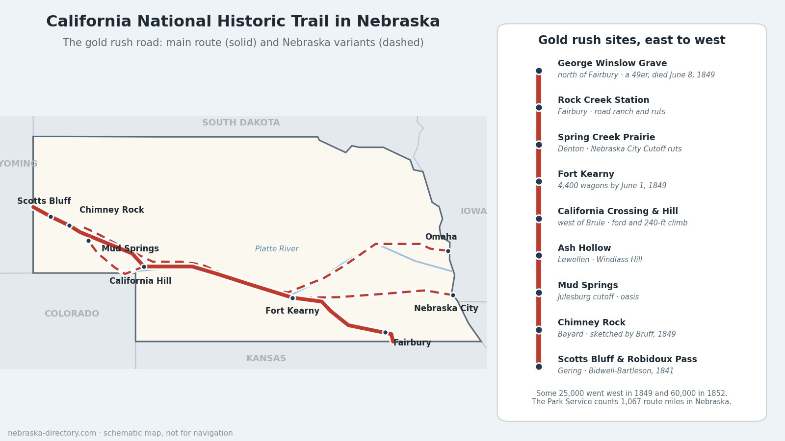
California National Historic Trail
Oregon Trail were the same road for hundreds of miles, up the Platte River past Fort Kearny, Ash Hollow and Chimney Rock. What made it the California Trail was who was on it. After gold was found in California in 1848, tens of thousands of "forty-niners" poured up both sides of the Platte, most of them young men in a hurry. They came from more starting points than the Oregon emigrants did, cut new shortcuts across Nebraska, and left a trail of diaries, sketches and graves behind them.
Trail at a Glance
- Designated: August 3, 1992, by the same law (Public Law 102-328) that created the Pony Express National Historic Trail.
- Length: more than 5,000 miles of routes and cutoffs, according to the National Park Service, or about 2,000 miles end to end, across ten states.
- In Nebraska: the Park Service counts 1,067 miles of original route in Nebraska, including the alternate routes.
- Travelers: more than 250,000 people went to California by this trail in the 1840s, 1850s and 1860s.
- Managed by: the National Park Service's National Trails Office, with states, landowners and partners. Most of the route is on private land and is followed today by roads and markers.
The Gold Rush on the Platte
The first emigrants bound for California, the Bidwell-Bartleson party of 1841, about 69 people, followed the Platte past Courthouse Rock, Chimney Rock and Scotts Bluff and became the first wagon train to use Robidoux Pass. Five years later the Donner Party came through. On June 16, 1846, near the forks of the Platte, Tamsen Donner wrote home that the prairie between the Blue and the Platte rivers was beautiful beyond description; the same day James Reed counted more than 500 wagons on the road.
Then came gold. By the Park Service's count about 25,000 people went west in 1849, nearly 50,000 in 1850 and some 60,000 in 1852, on all the trails together. By June 1, 1849, about 4,400 wagons had already passed Fort Kearny. Diarists wrote of an unending stream of wagon trains and of a nation pouring itself out onto the plains. Cholera raced them up the Platte from 1849 to 1852 and killed hundreds, perhaps thousands. Fort Kearny built a four-room hospital in the summer of 1849, and one traveler of 1852 remembered that for 400 miles "the road was almost a solid graveyard."
Routes Across Nebraska
From Kansas: the St. Joseph and Independence Roads
Travelers from Independence and St. Joseph, Missouri, entered Nebraska near Fairbury and followed the Little Blue to Fort Kearny, past Rock Creek Station. North of Fairbury is the grave of George Winslow, a 25-year-old 49er from Massachusetts who died of cholera on June 8, 1849. A companion wrote that night that George was dead, his body lay in the tent, but his spirit had fled. His original headstone is set into a 1912 granite monument.
From the Missouri River towns
By the early 1850s most of the traffic started farther north, from Council Bluffs and Kanesville in Iowa and from Omaha, Bellevue, Plattsmouth and Nebraska City, cutting off nearly 200 miles. Historian Merrill Mattes found that at least a third of all Platte travelers used the north bank, the road the Mormons had opened in 1847 (see the Mormon Pioneer Trail). In 1849 J. Goldsborough Bruff's 66-man company skipped the crowded ferry at St. Joseph and crossed the Missouri at old Fort Kearny, today's Nebraska City.
From Nebraska City the Ox-Bow Trail ran northwest, crossing Salt Creek near Ashland and meeting the Platte valley south of Columbus; ruts of its Woodbury Cutoff in Butler County are on the National Register. After 1860 the Nebraska City–Fort Kearny Cutoff gave freighters and late emigrants the shortest road to the fort. Its wagon ruts survive at Spring Creek Prairie Audubon Center near Denton.
The California Crossing
West of the forks of the Platte, most wagons forded the South Platte about 4 miles west of Brule. Margaret Frink, crossing in 1850, watched men wading against the quicksand and current, feeling their way with long poles. The wagons then climbed California Hill, whose name tells where they were going; its ruts are still plain. Names for the crossings were used loosely: the Park Service calls this one both the Lower California Crossing and the Upper Crossing, and another ford near Julesburg, Colorado, was also called the Upper California Crossing.
The Julesburg and Mud Springs cutoff
By 1860 many travelers followed the South Platte all the way to Julesburg, then struck north to the North Platte near Courthouse Rock. The springs at Mud Springs, north of Dalton, were the oasis on that dry stretch, and the Pony Express and stage line used the same route up Lodgepole Creek.
The North Platte landmarks
All the routes came together along the North Platte at Courthouse and Jail Rocks, Chimney Rock and Scotts Bluff. Alonzo Delano thought Chimney Rock looked like the chimney of a glass-house furnace, Bruff sketched it, and one 1849 traveler wrote that if it stood back in the states, people would come from everywhere to see it.
Places to Visit
- Rock Creek Station State Historical Park — 57426 710th Rd., Fairbury; 402-729-5777. Ruts and a rebuilt road ranch. Park entry permit required.
- George Winslow Grave — north of Fairbury on private pasture land, open to visitors; close the gates.
- Spring Creek Prairie Audubon Center — 11700 SW 100th St., Denton; 402-797-2301. Nebraska City Cutoff ruts on a tallgrass prairie. Free.
- Fort Kearny State Historical Park — 1020 V Rd., Kearney; 308-865-5305. Where the feeder roads met.
- The Archway — over Interstate 80, east of Kearney.
- California Hill — U.S. 30, about 4.5 miles west of Brule.
- Ash Hollow State Historical Park — 4265 U.S. 26, Lewellen; 308-778-5651.
- Mud Springs Station — about 1.5 miles west of U.S. 385, north of Dalton.
- Chimney Rock National Historic Site — 9822 County Rd. 75, Bayard; 308-586-2581.
- Scotts Bluff National Monument and Robidoux Pass — Gering; 308-436-9700.
Driving the Trail Today
The Park Service's auto tour route has three ways in: from Kansas through Fairbury, from Nebraska City, and from Omaha. They meet along the Platte and follow U.S. 30 and Interstate 80 west, with a choice at Ogallala between the South Platte road toward Julesburg and U.S. 26 up the North Platte. Highway 92 and U.S. 26 carry the route past the Panhandle landmarks into Wyoming. Gering's Oregon Trail Days, every July since 1921, and Rock Creek Trail Days in June celebrate the trails today.
Trail Cameras
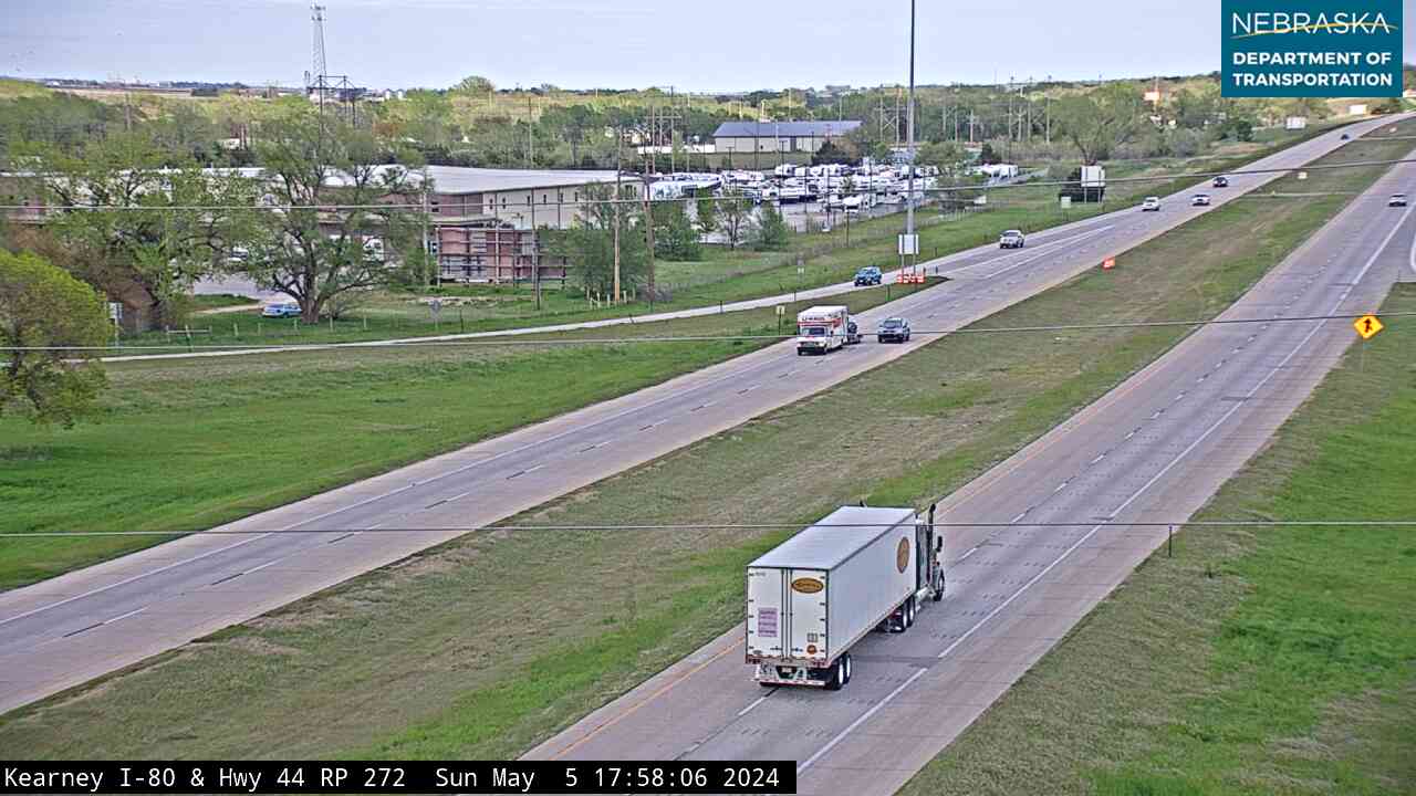
Live images from Nebraska 511 cameras along the California Trail routes, east to west. Click a picture for the full-size view. For every camera in the state, see Nebraska Cameras.

Related Trails and Corridors
- Oregon National Historic Trail — the same road across most of Nebraska
- Mormon Pioneer National Historic Trail — the north-side road many 49ers also used
- Pony Express National Historic Trail
- Great Platte River Road
- Interstate 80, US Highway 30, US Highway 136 and Nebraska Highway 92
- ← All Nebraska Trails
size:1.1em;color:#555;margin-bottom:20px;">The gold rush route west — Nebraska's segment shares the Platte River valley with the Oregon Trail.
The California National Historic Trail shares its Nebraska route with the Oregon National Historic Trail through the Platte River valley. Beginning in 1841 and surging after the 1848 gold rush, an estimated 250,000 emigrants used this corridor to reach California. The trails diverge only after Fort Hall in present-day Idaho.
Trail Information
- Nebraska Length: ~450 miles (shared with Oregon Trail)
- Route: Southeast Nebraska → Platte River valley → Scotts Bluff → Wyoming border
- Designation: National Historic Trail (NPS)
- Peak Years: 1849–1855 (Gold Rush era)
Nebraska Route & Key Sites
In Nebraska, the California Trail follows the same corridor as the Oregon Trail. See the Oregon National Historic Trail page for complete county, town, and landmark information. Key sites include Fort Kearny, Chimney Rock, and Scotts Bluff National Monument.
Points of Interest
- Scotts Bluff National Monument — where California-bound emigrants passed through Mitchell Pass
- Chimney Rock National Historic Site
- Fort Kearny State Historical Park
- Rock Creek Station State Historical Park
History
When gold was discovered at Sutter's Mill in January 1848, the rush to California transformed the emigrant trail into a highway. In 1849 alone, an estimated 30,000 "forty-niners" passed through Nebraska. The California Trail followed the same Platte River route as the Oregon Trail until reaching Fort Hall in Idaho, where it turned southwest toward the Sierra Nevada.
Find Nearby Services
Lodging · Dining · Fuel & Services · Outdoor Recreation
Navigate
Nebraska Trails | Oregon Trail (shared Nebraska route) | Explore Nebraska