
Sioux County, Nebraska
County Seat: Harrison
Founded: 1887
Named For: The Sioux people
License Plate Prefix: 80
Population: 1,135 (2020 census)
Area: 2,067 sq mi
History
Sioux County was established in 1887 and named after the Sioux Nation, whose presence shaped the region long before settlement. The county seat, Harrison, was founded as a frontier community serving ranchers, homesteaders, and travelers moving through the rugged Pine Ridge country. The area’s early history includes Native American heritage, military activity, and the development of large ranching operations across the high plains.
The county’s remote location and dramatic landscapes have preserved much of its frontier character. Ranching remains the dominant economic force, supported by generations of families who have lived and worked in the region for more than a century.
Geography
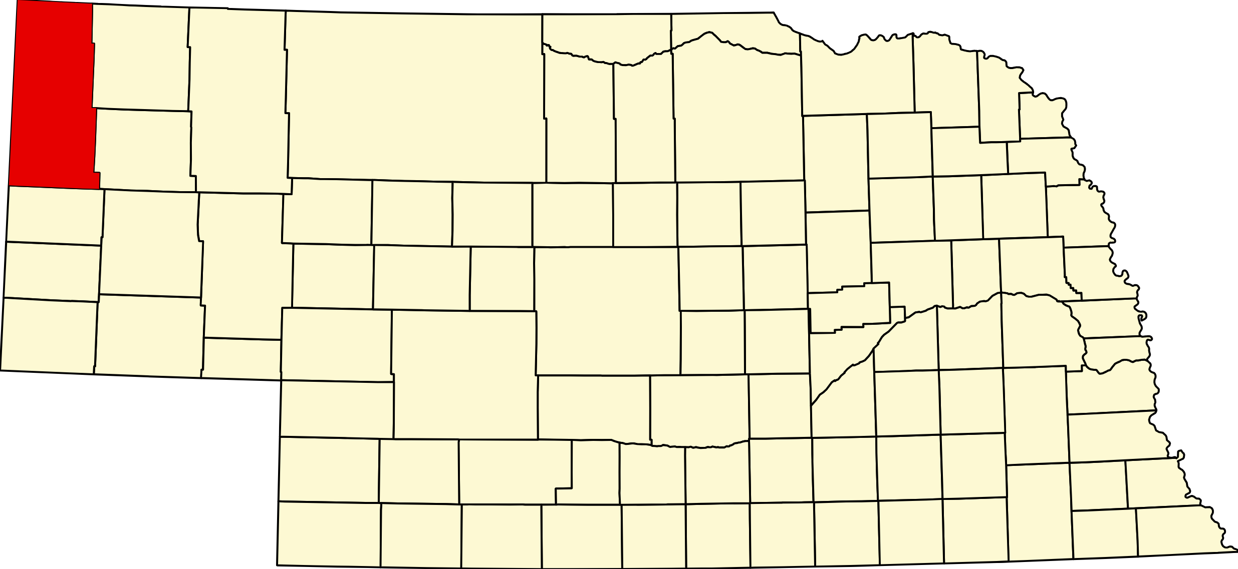
Location: Northwestern Nebraska, bordering Wyoming and South Dakota
Landscape: Pine Ridge buttes, canyons, high plains grasslands, and rugged scenic terrain
Adjacent Counties:
- Dawes County (east)
- Scotts Bluff County (southeast)
- Banner County (south)
- Niobrara County, Wyoming (west)
- Goshen County, Wyoming (southwest)
- Weston County, Wyoming (northwest)
- Oglala Lakota County, South Dakota (north)
Culture & Landmarks
- Agate Fossil Beds National Monument – One of the world’s richest Miocene fossil sites, with museum exhibits and scenic trails.
- Toadstool Geologic Park – Unique badlands formations, hiking trails, and paleontological features.
- Fort Robinson State Park (nearby in Dawes County) – A major historic and recreational destination closely tied to Sioux County’s heritage.
Notable Communities
- Harrison – County seat and primary community.
- Andrews – Rural settlement near the Pine Ridge region.
- Glen – Small community with deep ranching roots.
Events & Attractions
- Sioux County Fair – Rodeo events, livestock shows, and community celebrations.
- Fossil and Geology Tourism – Agate Fossil Beds, Toadstool Park, and surrounding badlands.
- Pine Ridge Recreation – Hiking, horseback riding, wildlife viewing, and scenic drives.
Living in Sioux County
Sioux County offers a quiet, remote lifestyle rooted in ranching, natural beauty, and frontier heritage. Harrison provides essential services, while the county’s vast landscapes support outdoor recreation and wildlife. Residents value the area’s independence, open spaces, and strong connection to Nebraska’s high‑country history.
Outdoors — Camping, RV, Hunting & Fishing
Plan ahead here. Sioux County has almost no developed camping: one small private full-hookup park in Harrison, one no-service Forest Service campground at Toadstool, and free primitive camping on a WMA. There is no state park campground and no public dump station anywhere in the county that could be confirmed. Fuel and water before you leave the highway.
Camping and RV
Sage Motel & Sioux Campground, 398 East Highway 20, Harrison. (308) 665-5300. Private, 12 full-hookup sites at 20/30/50 amp, water and sewer at each. Back-in, gravel and grass, level; reviewers report it handles rigs to about 33 feet. Around $25 a night, open year round, weekly rates. An adjoining horse motel makes it useful for equestrian travelers. It fronts US-20, so expect road noise. Showers and a separate dump station are not confirmed — each site has sewer.
Toadstool Campground, Oglala National Grassland. 12 sites with tables, fire rings and grills, two vault toilets, and no potable water, no electricity and no dump station — bring everything. Day-use pass $3 a vehicle, camping fee separate; reservable through Recreation.gov. Open year round, fourteen-day limit. A reconstructed sod house stands on site and a one-mile interpretive loop runs out into the badlands.
Getting there matters: from Crawford, north 4.2 miles to Toadstool Road, then 11.4 miles to Forest Road 902, then 1.4 miles. Toadstool Road is unpaved and the clay turns greasy after rain — not a road for a big fifth-wheel in wet weather.
Gilbert-Baker WMA, five miles north of Harrison on Monroe Canyon Road, has free primitive camping in a designated zone with a vault latrine and a hand water pump. No power, no dump, no showers, no fee. Standard WMA rules: fourteen days in any thirty, no open fires and no alcohol.
Coffee Park on Sowbelly Canyon Road is day use only — picnic shelters and vault toilets, no camping. ⚠ Sowbelly Canyon Road is minimum-maintenance with no snow removal; it closes in autumn and stays closed until the last drifts melt in late spring. Most of the eleven-mile canyon is private land, so sightsee from the vehicle except at the park.
Fishing
Monroe Creek through Gilbert-Baker WMA is a trout stream, with Gilbert Baker Pond alongside. The Niobrara and White River headwaters rise in the county but are small and largely private. The Oglala National Grassland has scattered stock ponds. There is no reservoir and no confirmed boat ramp in the county. A fishing permit is required; no park entry permit applies on WMA, Forest Service or National Monument ground.
Hunting
Gilbert-Baker WMA, about 2,537 acres of Sowbelly and Monroe canyon country five miles north of Harrison, carries deer, elk, turkey, dove, cottontail and squirrel. The Oglala National Grassland adds tens of thousands of acres of walk-in public land. Elk permits in the Pine Ridge are tightly limited and drawn — check current Game and Parks seasons rather than assuming.
Worth the drive
Toadstool Geologic Park — badlands of banded clay and sandstone with the mushroom-shaped formations that name it, and the Hudson-Meng Bison Bonebed nearby, where hundreds of bison died together some 10,000 years ago. Agate Fossil Beds National Monument on the Niobrara holds Miocene mammal quarries and the James Cook collection of Lakota artefacts. Agate has no campground.
Sioux County at a Glance
Sioux County, Nebraska — the state’s far north-west corner, created in 1877 as the parent county of the whole northern Panhandle. County seat Harrison, at 4,876 feet the highest town in Nebraska and the county’s only incorporated place. 66 listings across 5 towns.
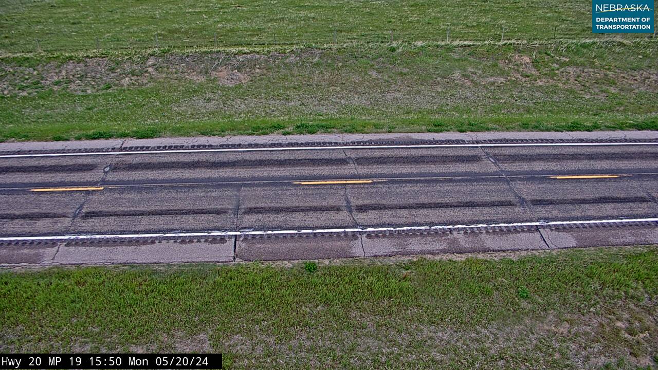
Getting there: US-20 enters Nebraska here from Wyoming and runs east through Harrison; NE-29 runs north to south through the Pine Ridge.
For visitors: the Pine Ridge escarpment and Sowbelly Canyon north-east of Harrison; Toadstool Geologic Park and the Hudson-Meng bison bonebed on the Oglala National Grassland, badland country unlike anywhere else in the state; and Agate Fossil Beds National Monument on the Niobrara. This is the emptiest county in Nebraska — plan fuel and water before you leave the highway.
Vehicles registered in Sioux County carry license plate number 80. See what every Nebraska county number means.
Sioux County Businesses & Places
66 listings in Sioux County.
Click a category to see the businesses.
Eat & Drink (2)
- Matt Tighe Longhorn Saloon & Grill — Restaurant, Harrison
- The Longhorn Saloon & Grill — Bar & Grill, Harrison
Stay (3)
- Harrison House Hotel — Hotel, Harrison
- Sage Motel — RV Park, Harrison
- Sioux RV Park & Campground — RV Park, Harrison
Outdoors & Recreation (7)
- Agate Fossil Beds National Monument — National Parks & Monuments, Harrison
- Fort Robinson WMA — Public Hunting Areas & WMAs, Harrison
- Gilbert-Baker WMA — Campgrounds & RV Parks, Harrison
- Harrison City Park — Campgrounds & RV Parks, Harrison
- Oglala National Grassland - Harrison — National Parks & Monuments, Harrison
- Peterson WMA — Public Hunting Areas & WMAs, Harrison
- Sage Motel & Campground — Campgrounds & RV Parks, Harrison
Places to Visit (6)
- Coffee Siding — Historic Marker, Harrison
- Fort Laramie - Fort Robinson Trail Historical Marker — Historic Marker, Harrison
- Harrison City Park — City Parks, Harrison
- Scenic Overlook near Harrison NE — Natural Sites, Harrison
- Sioux County Historical Museum — History & Heritage Museums, Harrison
- The Cheyenne Outbreak — Historic Marker, Harrison
Events & Venues (3)
- Harrison Swann Community Site — Community Center, Harrison
- Sioux County Fair — County Fair, Harrison
- Sioux County Fairgrounds — Fairground, Harrison
Shopping & Gifts (1)
- Harrison Market — Grocery, Harrison
Community & Faith (18)
- Andrews Cemetery — Andrews — Cemeteries, Andrews
- Bannan Family Cemetery — Harrison — Cemeteries, Harrison
- Bodarc Cemetery — Cemeteries, Montrose
- Church of the Nativity of the Blessed Virgin Mary Harrison — Catholic Church, Harrison
- Coliseum Butte Cemetery — Harrison — Cemeteries, Harrison
- Cook Gravesite — Agate — Cemeteries, Agate
- Glendale Cemetery — Cemeteries, Glen
- Harrison Bible Church — Non-Denominational Church, Harrison
- Harrison Cemetery — Harrison — Cemeteries, Harrison
- Harrison Memorial UMC — Methodist Church, Harrison
- Mason Family Cemetery — Glen — Cemeteries, Glen
- Montrose Cemetery — Montrose — Cemeteries, Montrose
- Pioneer Cemetery — Sioux County — Cemeteries, Montrose
- Saint Mary Cemetery — Harrison — Cemeteries, Harrison
- Scandinavian Lutheran Cemetery — Glen — Cemeteries, Glen
- Sheep Creek Presbyterian Church Cemetery — Cemeteries, Agate
- Union Star Cemetery — Cemeteries, Glen
- Unit Cemetery — Cemeteries, Glen
Government & Resources (15)
- Harrison Post Office — Post Office, Harrison
- Harrison Volunteer Fire Department — Fire Station, Harrison
- Sioux County Assessor — County Assessor, Harrison
- Sioux County Attorney's Office — County Attorney, Harrison
- Sioux County Clerk — County Clerk, Harrison
- Sioux County Court — County Court, Harrison
- Sioux County Courthouse — Court House, Harrison
- Sioux County Driver License Office — County Driver License, Harrison
- Sioux County Emergency Management — Emergency Management, Nebraska
- Sioux County Public Library - Harrison — Libraries, Harrison
- Sioux County Sheriff — County Sheriff, Harrison
- Sioux County Treasurer — County Treasurer, Harrison
- Sioux County Veterans Service Office — Veterans Office, Harrison
- Sioux County Weed Superintendent — County Weed Control, Harrison
- Sunshine Senior Center - Harrison — Senior Citizen Center, Harrison
Education (6)
- Chalk Butte School — Elementary & Middle School, Harrison
- Harrison Grade School — Elementary & Middle School, Harrison
- Pink School — Elementary & Middle School, Harrison
- Sioux County Extension — County Extension Office, Harrison
- Sioux County High School — High School, Harrison
- Sioux County Public Schools — School District (K-12 / General), Harrison
Transportation (1)
- Harrison Skyranch — Private Airport / Airstrip, Harrison
Automotive (1)
- Hillside Service — Fuel & Gas Station, Harrison
Media (1)
- K08LN-D Channel 13 - Harrison — TV Translator, Harrison
Manufacturing & Industrial (1)
- Rudloff Trucking LLC — Trucking Company, Harrison
Utilities (1)
- Village of Harrison — Water Utility / District, Harrison
Agriculture & Farm (1)
- WESTCO – Harrison — Farm Coop, Harrison