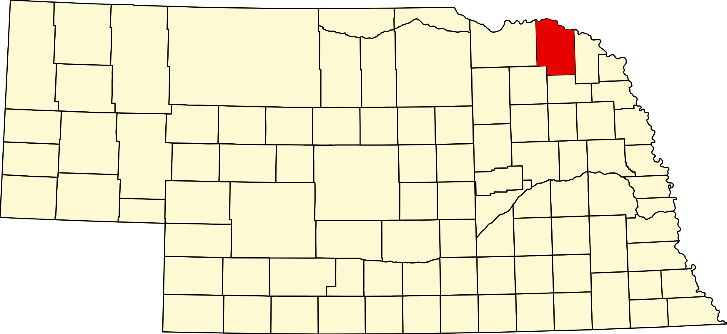
Cedar County, Nebraska (Plate 13)

Cedar County, Nebraska

Cedar County occupies the northeastern corner of Nebraska, bounded by Knox County to the west, Wayne County to the south, Dixon County to the northeast, and the Missouri River forming the northern border with South Dakota. The county seat, Hartington, anchors the southern half, while the Lewis and Clark National Scenic Byway (Nebraska Highway 12) traces the northern bluffs above the Missouri River through Wynot, Saint Helena, and other historic communities.

The county was organized in 1857, making it one of Nebraska's earliest. Czech and German immigrant families shaped Cedar County's cultural landscape through the late nineteenth and early twentieth centuries, establishing the parishes, schools, and cooperative traditions that still define the region. US-20, the historic Lincoln Highway–era route, runs through the northern tier of the county at Randolph, Belden, and Laurel. The Gavins Point Dam and Lewis and Clark Lake, just across the Knox County border near Crofton, draw travelers to the broader region.

Agriculture — primarily grain and livestock — defines Cedar County's economy. The Missouri River bluffs of the northern county offer some of the most scenic terrain in northeastern Nebraska, attracting visitors exploring the Lewis and Clark corridor.

Towns in Cedar County

Browse all Cedar County towns →

Hartington, Nebraska (68739)

Hartington is the Cedar County seat, a city of approximately 1,500 in the central county. It serves as the commercial and government hub for the region, with Mary Lanning–area healthcare, local schools, and a lively downtown.

Pop: ~1,500 | Highways: NE-57 area | Designation: City

Town Page · Cameras

Laurel, Nebraska (68745)

Laurel is a village on US-20 (MM 392) in northern Cedar County, one of the county's larger communities. It sits along the historic US-20 corridor with agricultural services and local commerce.

Pop: ~1,000 | Highways: US-20 MM 392 | Designation: Village

Town Page · Cameras

Randolph, Nebraska (68771)

Randolph is a village on US-20 (MM 371) in northern Cedar County. The community anchors the western end of Cedar County's US-20 corridor.

Pop: ~950 | Highways: US-20 MM 371 | Designation: Village

Town Page · Cameras

Coleridge, Nebraska (68727)

Coleridge is a village in southern Cedar County, serving the farming communities of the county's lower half. It provides local services to surrounding rural neighborhoods.

Pop: ~450 | Highways: NE-57 area | Designation: Village

Town Page · Cameras

Wynot, Nebraska (68774)

Wynot is a village in northern Cedar County along NE-12, perched above the Missouri River bluffs with sweeping views into South Dakota. Its famously quirky name comes from a community meeting where settlers kept asking "why not here?"

Pop: ~260 | Highways: NE-12 | Designation: Village

Town Page · Cameras

Belden, Nebraska (68717)

Belden is a small village on US-20 (MM 386) between Randolph and Laurel in northern Cedar County. It sits along the historic east–west US-20 corridor.

Pop: ~150 | Highways: US-20 MM 386 | Designation: Village

Town Page · Cameras

Obert, Nebraska (68757)

Obert is a village along the NE-12 corridor in northeastern Cedar County, near the Missouri River bluffs. It connects the northern Cedar County communities along the Lewis and Clark route.

Pop: ~80 | Highways: NE-12 | Designation: Village

Town Page · Cameras

Fordyce, Nebraska (68736)

Fordyce is a small village in eastern Cedar County near the Missouri River. It sits along the NE-12 corridor in the bluff country of the county's northeastern corner.

Pop: ~80 | Highways: NE-12 | Designation: Village

Town Page · Cameras

Saint Helena, Nebraska (68774)

Saint Helena is a small village in northern Cedar County along NE-12, named for the Catholic heritage of the region. It connects Wynot to the communities of eastern Cedar County.

Pop: ~70 | Highways: NE-12 | Designation: Village

Town Page · Cameras

Magnet, Nebraska (68749)

Magnet is a small village in southeastern Cedar County, serving area farm families in the southern agricultural districts of the county.

Pop: ~60 | Highways: NE-15 area | Designation: Village

Town Page · Cameras

Menominee, Nebraska (68774)

Menominee is a small village in eastern Cedar County near the Missouri River, part of the NE-12 corridor communities of the county's northeastern edge.

Pop: ~60 | Highways: NE-12 | Designation: Village

Town Page · Cameras

Aten, Nebraska (68730)

Aten is an unincorporated community in western Cedar County near the Knox County border, using Crofton's ZIP code area. It sits in the hill country west of Hartington.

Pop: ~30 | Designation: Unincorporated

Town Page · Cameras

South Yankton, Nebraska

South Yankton is an unincorporated community in northern Cedar County near the South Dakota border, opposite Yankton, SD across the Missouri River.

Pop: ~25 | Designation: Unincorporated

Town Page · Cameras

Additional unincorporated communities: Bow Valley · Constance · Pleasant Valley · Saint James

Cedar County Cameras

View Cedar County cameras →

Cedar County Business Directory

Browse Cedar County Listings →

Find places to eat, stay, and explore across Cedar County. Full Directory →

Adjacent Counties

Knox County (west) · Wayne County (south) · Dixon County (northeast) · South Dakota (north, across Missouri River)

CEDAR COUNTY WEATHER

County Seat: Hartington
Founded: Created and organised February 12, 1857
Named For: The cedar groves along the county’s rivers
License Plate Prefix: 13
Population: 8,380 (2020 census)
Area: 746 sq mi

History

Cedar County was created in 1857 and takes its name from the red cedars along the Missouri bluffs. Hartington has been the county seat since 1885, when it won the seat from St James after a contested vote — the town was named for the Marquess of Hartington, a British investor in the railroad that built it.

The county’s character is German and Luxembourger Catholic, and it shows: Hartington, Fordyce, Constance, St Helena, Bow Valley, Wynot and Menominee all grew around their parishes, and ten of them consolidated their schools into Cedar Catholic High School in 1964. The Saints Peter and Paul Catholic Church Complex at Bow Valley, listed on the National Register in 2000, is the finest building in the county — Late Gothic Revival by Josef Schwartz and Henry Stukenoff, with a 1926 rectory, a school and the 1952 Grotto of Our Lady of Fatima.

Geography

Cedar County covers about 740 square miles in north-east Nebraska, bounded on the north by the Missouri River and the South Dakota line. The north is bluff and chalk-rock country falling to the river; inland it is rolling farmland drained by Bow Creek and its tributaries. It borders Knox County to the west, Pierce County to the south-west, Wayne County to the south and Dixon County to the east.

Gavins Point Dam sits on the county line, joining Cedar County to Yankton County, South Dakota — which means the Corps of Engineers recreation areas below the dam are in Nebraska, in Cedar County, despite carrying Yankton mailing addresses.

Outdoors — Camping, RV, Hunting & Fishing

There is no Nebraska state park or state recreation area in Cedar County. The developed camping here is federal — Corps of Engineers ground below Gavins Point Dam — plus municipal sites.

Camping and RV

Cottonwood Recreation Area (Corps of Engineers), on Lake Yankton below the dam. 77 campsites, all with electric. Two modern shower houses with flush toilets, potable water, playground, boat ramp. The dump station is on Toe Road north of the campground, not inside the camping loop — plan the exit. Reservable through recreation.gov.

Nebraska Tailwaters Recreation Area (Corps of Engineers), 55291 Highway 121, on the south bank immediately below the dam. 36 sites — 34 electric, 2 tent-only — plus a group area. RV dump station on site, potable water, modern showers, fish-cleaning station, two-lane boat ramp and an accessible fishing pier. Roughly $18–$20, season reported May to October. Firewood movement is restricted for emerald ash borer.

City of Hartington Campground, Broadway and Felber Streets. Six concrete pads with full hookups — 30 and 50 amp, water and sewer — and a sanitary dump station on site. $25 a night, open year round, but the water is shut off around 15 November.

Laurel City Park, 302 Cedar Street. Five sites with 30-amp electric, $10 a night, pay at city hall. There is no dump station at Laurel — the nearest reported is at Ponca, about thirty miles away in Dixon County. Worth knowing before you arrive.

Randolph, Coleridge and Obert have municipal sites, and Bob’s Campground at Randolph is a private full-hookup park on US-20; none publishes reliable hookup or fee detail, so ring first. Three river accesses — St Helena, Brooky Bottom and Bow Creek — allow primitive camping. Bow Creek is reachable only from the water: carry-in launch, no vehicle access to the river, no restrooms and no water.

Fishing

Lake Yankton — 332 acres, in Cedar County. Bluegill, carp, channel catfish, crappie, largemouth bass and walleye, with a 15-inch minimum on black bass and a fifteen-a-day panfish bag. Boat ramp at the Cottonwood day-use area.

Chalkrock WMA — a 44-acre lake in the north of the county near Menominee. Bluegill, channel catfish and largemouth bass. No live baitfish may be used or possessed. Boat ramp, but no restrooms.

The Missouri River below Gavins Point is a tailwater fishery, with ramps at Nebraska Tailwaters, Training Dike, St Helena and Brooky Bottom. No Nebraska park entry permit applies anywhere in the county — the WMA, NRD and Corps areas do not require one — just a fishing permit. The current below the dam is serious; the Park Service specifically warns about landing at St Helena.

Hunting

Chalkrock WMA, 130 acres including the lake, is the county’s main public ground — deer, pheasant and waterfowl, owned by the Lewis & Clark NRD and managed with Game and Parks. Wiseman WMA lies in the Missouri bottoms but its acreage and management are not published. Beyond that, Cedar is an Open Fields and Waters and private-permission county; check the current Public Access Atlas.

Note: Buckskin Hills and Powder Creek WMAs are often listed with Cedar County. They are in Dixon County, near Newcastle.

Trails and the byway

The Outlaw Trail Scenic Byway (Nebraska Highway 12) runs the length of northern Cedar County through Wynot. The Training Dike Recreation Area below the dam is day-use only but has a paved multi-purpose trail, a swim beach, two boat ramps and a prairie restoration demonstration area. Goat Island, three miles long and publicly owned, lies opposite Brooky Bottom and allows primitive camping with no facilities whatever. There is no rail-trail in the county.

Events

The Cedar County Fair at Hartington anchors the summer, and the parish festivals at Fordyce, Bow Valley, St Helena and Wynot are long-standing community occasions.

Dates move year to year, so they are kept with the listings rather than repeated here.

Browse event listings in Cedar County →
Submit an event or correction →

Cedar County at a Glance

Cedar County, Nebraska — about 740 square miles of north-east farmland running up to the Missouri River bluffs, settled by German and Luxembourger Catholic families whose parish churches still mark every village. County seat Hartington. 236 listings across 17 towns.

Getting there: NE-12, the Outlaw Trail Scenic Byway, crosses the north through Wynot; US-20 runs along the south through Randolph and Laurel; NE-15 and NE-57 cross north to south.

For visitors: the Corps of Engineers campgrounds below Gavins Point Dam — Cottonwood and Nebraska Tailwaters, both in Cedar County despite Yankton addresses — with the Missouri tailwater fishery below them. The Saints Peter and Paul Church Complex at Bow Valley, on the National Register. Chalkrock Lake for quiet fishing.

Cedar County · Northeast Nebraska · County Cameras