Historic Marker

Displaying listings from all locations.

Use the fields below to filter listings for a particular country, city, or state. Start by selecting the top most region, the other fields will be automatically updated to show available locations.

Use the Clear Filter button if you want to start over.

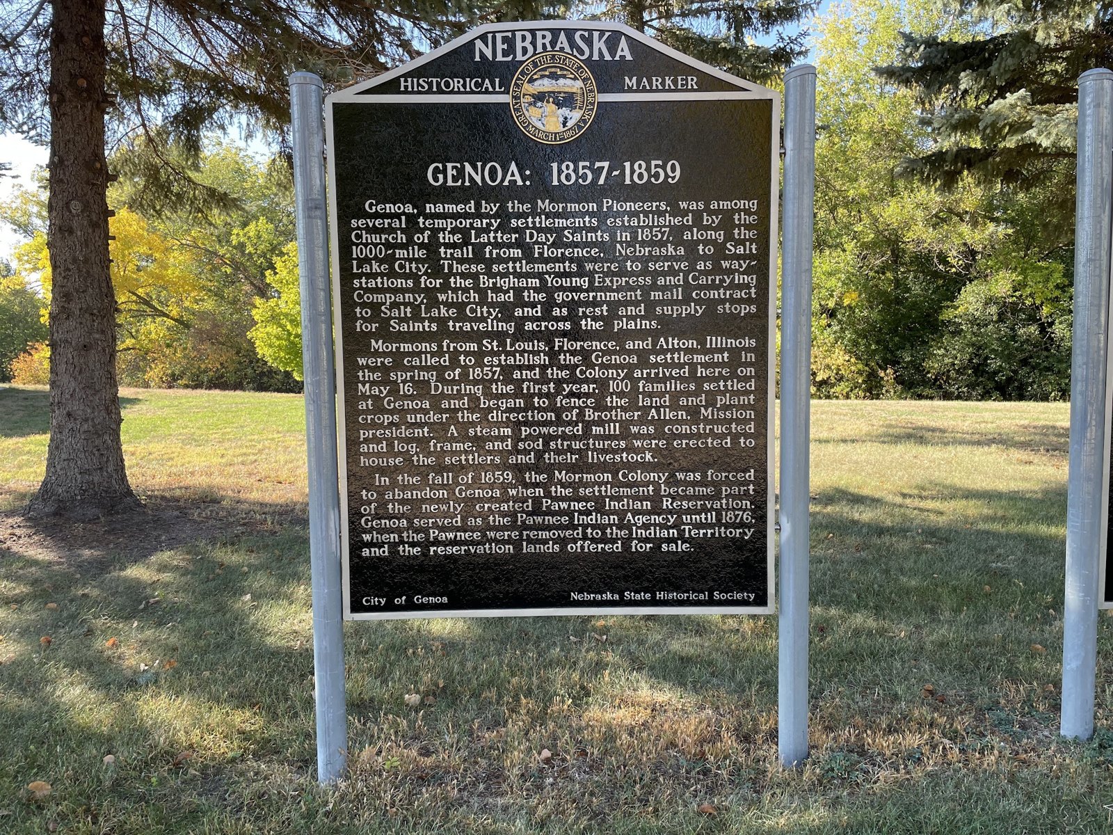
Pawnee and Genoa 1857–1859 Historical Markers
Average Rating
(More feedback needed)
Listing Category
Short Description

Two state markers in Genoa City Park on the Pawnee Nation and the Mormon settlement of 1857–1859.


Address
Genoa City Park, south entrance off S. Park St. (NE 39)
Genoa, NE
68640
Listing Tags
State
Nebraska
Country
USA
County
Nance County
Town
Genoa
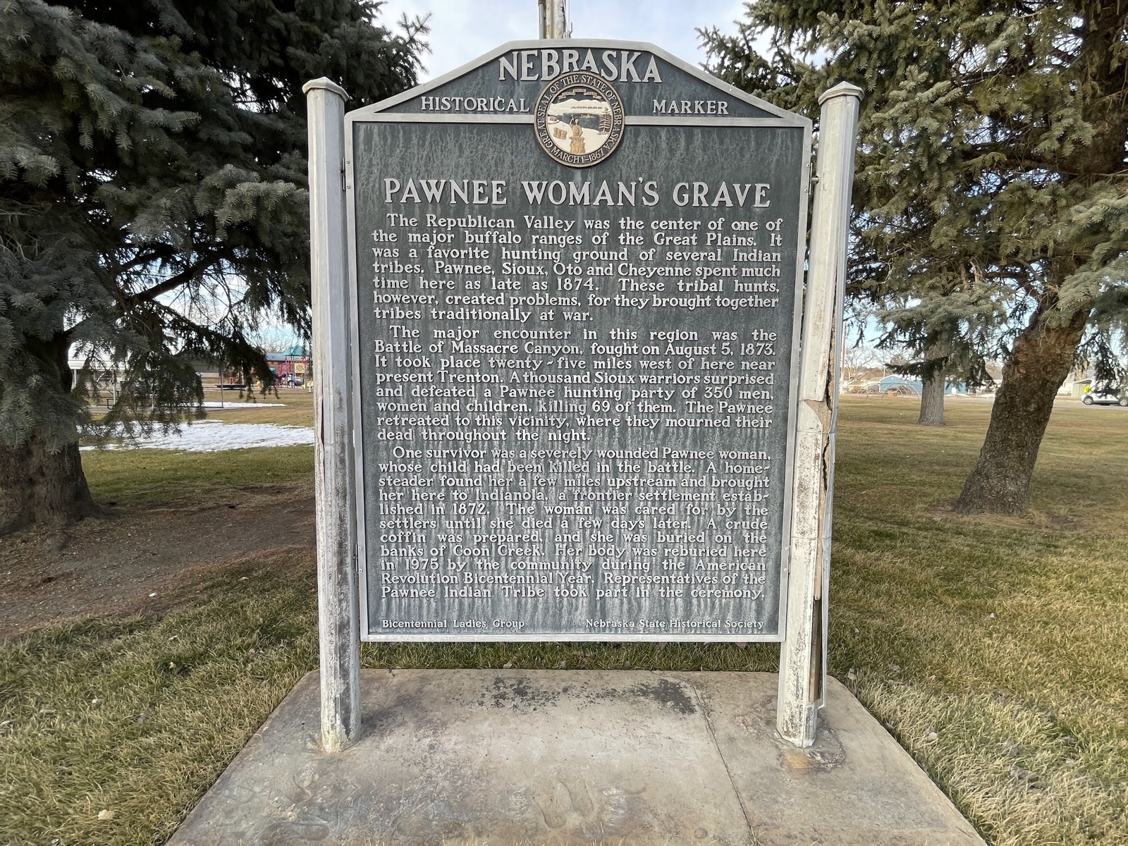
Pawnee Woman’s Grave Historical Marker
Average Rating
(More feedback needed)
Listing Category
Short Description

State marker and grave in Indianola's city park for a Pawnee woman wounded at Massacre Canyon in 1873, reburied there in 1975.


Address
City Park, Indianola
Indianola, NE
69034
State
Nebraska
Country
USA
County
Red Willow County
Town
Indianola
Average Rating
(More feedback needed)
Listing Category
Short Description

Phelps County was organized on April 23, 1873.


Address
Phelps County Historical Marker
5th Ave near the courthouse
Holdrege, NE
68949
State
Nebraska
Country
USA
County
Phelps County
Town
Holdrege
Average Rating
(More feedback needed)
Listing Category
Short Description

Nebraska historical marker No. 473 at Pleasant Hill Cemetery, about the town that was the Saline County seat from 1871 to 1878.


Address
County Road HH, 1/2 mi west of County Road 1600
Dorchester, NE
68343
State
Nebraska
Country
USA
County
Saline County
Town
Pleasant Hill
Average Rating
(More feedback needed)
Listing Category
Short Description

Plum Creek Prairie Historic Site Marker is in a pullout on the south side of US Highway 34, 0.1 mile west of Crooked Mile Road on the east edge of Seward.


Address
Plum Creek Prairie Historic Site Marker
US 34 pullout at the Plum Creek Trail trailhead
Seward, NE
68434
State
Nebraska
Country
USA
County
Seward County
Town
Seward
Average Rating
(More feedback needed)
Listing Category
Short Description

Plum Creek Railroad Attack Historical Marker is on US Highway 30, 0.1 mile west of Road 430, west of Lexington.


Address
US 30, 0.1 mi west of Road 430
Lexington, NE
68850
State
Nebraska
Country
USA
County
Dawson County
Town
Lexington
Average Rating
(More feedback needed)
Listing Category
Short Description

State historical marker in Plymouth telling of the 1872 New England colony and the town's move to the Rock Island line.


Address
Memorial Park, NE 4 and 723rd Rd.
Plymouth, NE
68424
State
Nebraska
Country
USA
County
Jefferson County
Town
Plymouth
Average Rating
(More feedback needed)
Listing Category
Short Description

Pole Creek Original Station Pony Express Marker stands in a pullout on the north side of US Highway 30, 1.5 miles east of County Route 117, about 4 miles east of Sidney.


Address
US 30, about 1.5 mi east of Road 117, east of Sidney
Sidney, NE
69162
Listing Tags
State
Nebraska
Country
USA
County
Cheyenne County
Town
Sidney
Ponca Trail of Tears - White Buffalo Girl
Average Rating
(More feedback needed)
Listing Category
Short Description

White Buffalo Girl, the infant daughter of Black Elk and Moon Hawk, died on May 23, 1877, during the forced removal of the Ponca people, and was buried in Neligh's Laurel Hill Cemetery.


Address
Ponca Trail of Tears - White Buffalo Girl
Neligh NE
Neligh, NE
68756
State
Nebraska
Country
USA
County
Antelope County
Town
Neligh
Average Rating
(More feedback needed)
Listing Category
Short Description

On the south side of West Walker Road, 0.9 miles west of South Buffalo Bill Avenue, southwest of North Platte.


Address
Pony Express Cold Springs Station Marker
West Walker Road
North Platte, NE
69101
State
Nebraska
Country
USA
County
Lincoln County
Town
North Platte
Average Rating
(More feedback needed)
Listing Category
Short Description

Adams County Historical Society marker on US 34 west of Juniata naming the county's six Pony Express stations.


Address
US 34, 0.3 mi west of S. Roseland Ave.
Juniata, NE
68955
Listing Tags
State
Nebraska
Country
USA
County
Adams County
Town
Juniata
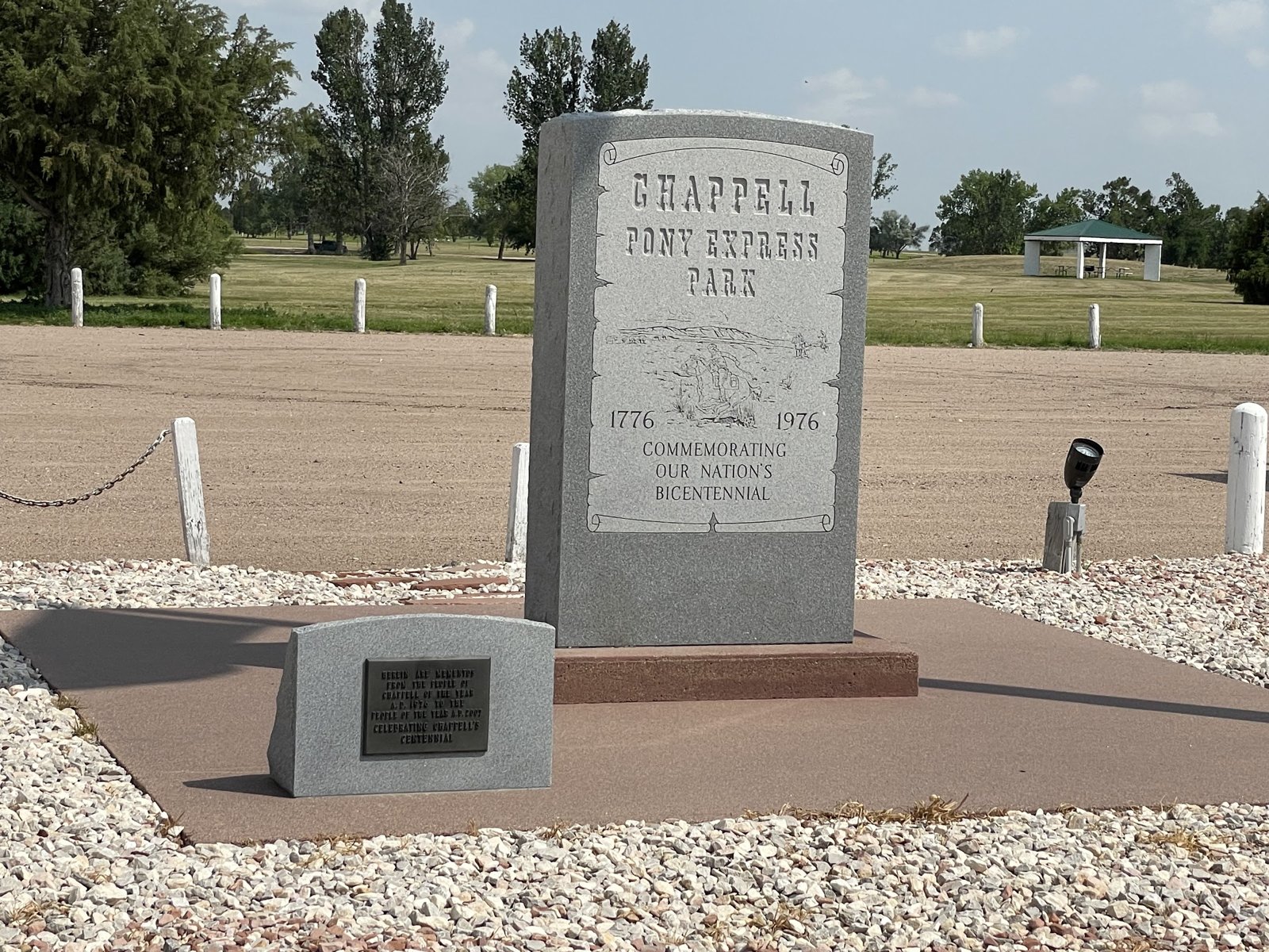
Pony Express Park Historical Markers
Average Rating
(More feedback needed)
Listing Category
Short Description

Markers at I-80 exit 85 in Chappell for the Lodgepole Creek valley (Pony Express, telegraph, railroad) and the 1944 B-24J bomber crash.


Address
L-25A, just north of I-80 exit 85
Chappell, NE
69129
State
Nebraska
Country
USA
County
Deuel County
Town
Chappell
Average Rating
(More feedback needed)
Listing Category
Short Description

State historical marker north of Benkelman on the 1944 side camp for German POWs from Camp Atlanta.


Address
NE 61, about 9.5 mi north of Benkelman
Benkelman, NE
69021
State
Nebraska
Country
USA
County
Dundy County
Town
Benkelman
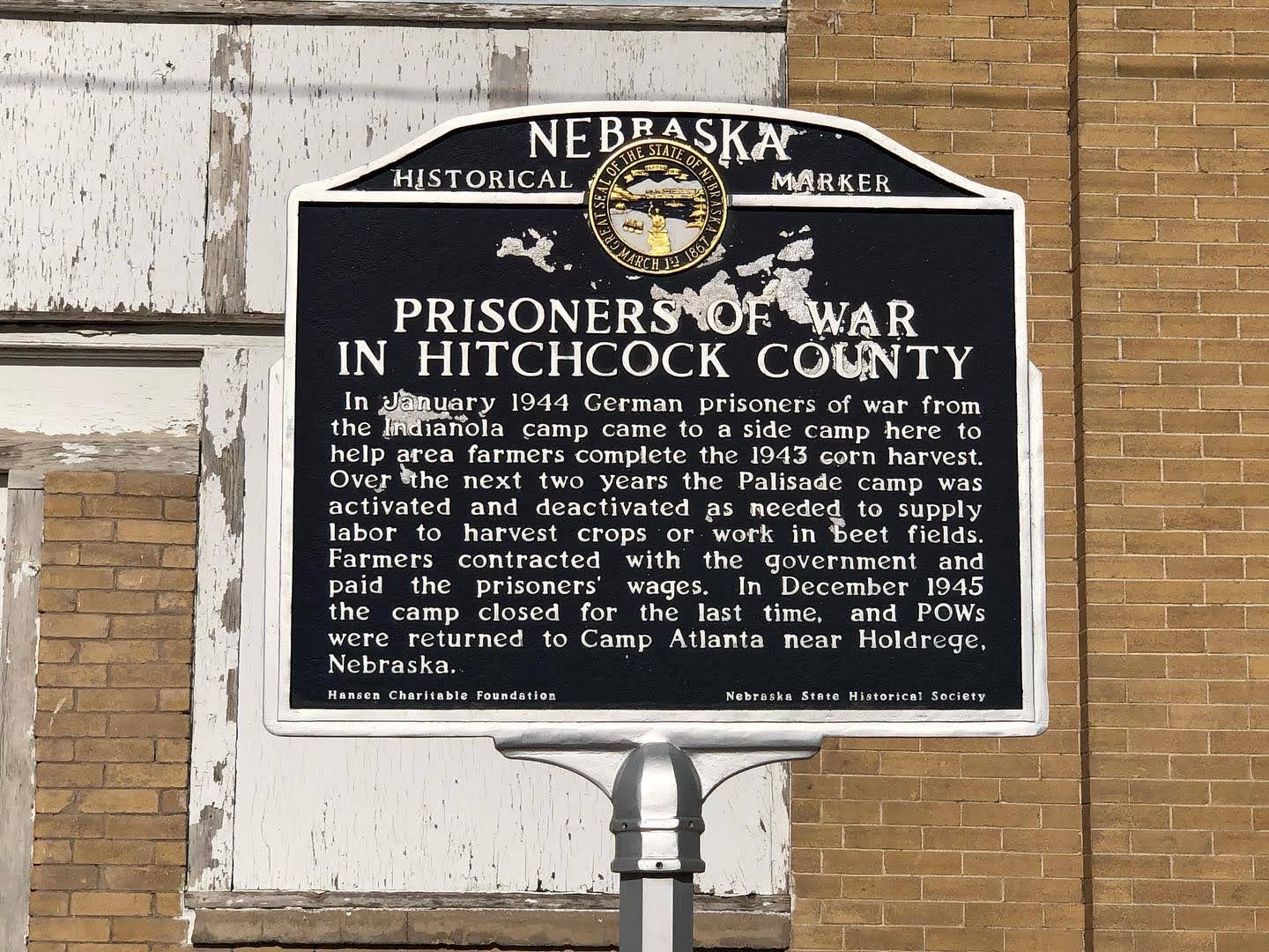
Prisoners of War in Hitchcock County Historical Marker
Average Rating
(More feedback needed)
Listing Category
Short Description

State historical marker in Palisade on the German POW side camp of 1944–45.


Address
213 N. Main St.
Palisade, NE
69040
State
Nebraska
Country
USA
County
Hitchcock County
Town
Palisade
Average Rating
(More feedback needed)
Listing Category
Short Description

City park on the Cowboy Trail in Atkinson with the "After 3 Tries, Atkinson Started" historical marker.


Address
207 N Front St
Atkinson, NE
68713
State
Nebraska
Country
USA
County
Holt County
Town
Atkinson
Average Rating
(More feedback needed)
Listing Category
Short Description

History Nebraska marker in Guide Rock on the Pawnee village that Zebulon Pike visited in 1806, a National Historic Landmark closed to the public.


Address
State St.
Guide Rock, NE
68942
State
Nebraska
Country
USA
County
Webster County
Town
Guide Rock
Average Rating
(More feedback needed)
Listing Category
Short Description

State historical marker on US 136 west of Oxford on the May 1935 Republican River flood, which killed more than 100 people.


Address
US 136, 1.2 mi west of Oxford
Oxford, NE
68967
Listing Tags
State
Nebraska
Country
USA
County
Furnas County
Town
Oxford
Average Rating
(More feedback needed)
Short Description

Gap in the Wildcat Hills west of Gering that carried the Oregon Trail around Scotts Bluff until about 1850. Graves, trail markers and good springs.


Address
Robidoux Pass
Gravel road 1 mi south of Five Rocks Rd. and Old Oregon Trail, about 9 mi west of Gering
Gering, NE
69341
State
Nebraska
Country
USA
County
Scotts Bluff County
Town
Gering
Average Rating
(More feedback needed)
Listing Category
Short Description

Site of the 1865 Battle of Rush Creek southeast of Broadwater, on the National Register.


Address
South side of the North Platte at the mouth of Rush Creek
Broadwater, NE
69125
State
Nebraska
Country
USA
County
Morrill County
Town
Broadwater
Average Rating
(More feedback needed)
Listing Category
Short Description

History Nebraska marker on the Wall of History in Rushville's Main Street Park, telling how Rush Valley moved to the railroad in 1885.


Address
Main Street Park, US 20 and S. Main St.
Rushville, NE
69360
State
Nebraska
Country
USA
County
Sheridan County
Town
Rushville