
- Clay County (1)
- Clay Center (1)
- Dawes County (1)
- Crawford (1)
- Hamilton County (1)
- Aurora (1)
- Holt County (2)
- O'Neill (2)
- Phelps County (1)
- Holdrege (1)
- Seward County (1)
- Seward (1)
The Clay Center historical marker from History Nebraska stands at 200 West Johnson Street in Clay Center.
200 W Johnson St
Clay Center, NE
68933
The Deep Well Irrigation historical marker on Q Street in Aurora tells how FE Edgerton sank a 225-foot irrigation well in 1931 and how deep-well irrigation helped farmers through the drought of the 1930s.
1201 Q St
Aurora, NE
68818
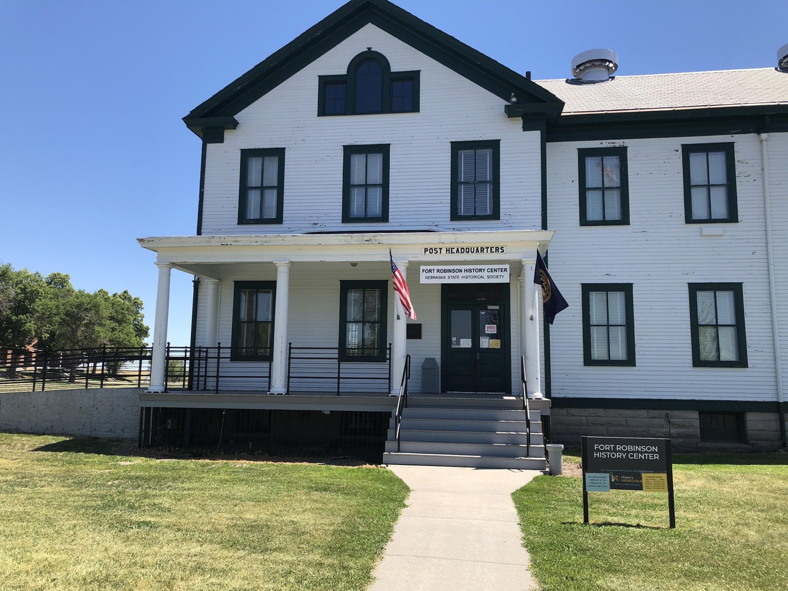
The Fort Robinson History Center at 3200 West Highway 20 near Crawford is run by History Nebraska, which opened a branch museum at the fort in 1955.
3200 W. US Hwy 20
Crawford, NE
69339
The O'Neill, Irish Capital of Nebraska historical marker, Nebraska State Historical Society marker 129, stands at the southwest corner of the Holt County Courthouse grounds at North 4th and East Clay Streets.
N 4th St and E Clay St
O'Neill, NE
68763
The Phelps County historical marker on 5th Avenue in Holdrege tells of the 1864 Plum Creek Massacre and of the county seat's moves from Williamsburg to Phelps Center in 1879 and to Holdrege in 1883.
5th Ave near the courthouse
Holdrege, NE
68949
The Seward, 4th of July City historical marker, Nebraska State Historical Society marker 221, stands at the southwest corner of the courthouse square at US 34 and South 6th Street.
US 34 and S 6th St
Seward, NE
68434
The US Highway 281 historical marker, Nebraska State Historical Society marker 228, is at a pull-out on the west side of US 281, 8.6 miles south of US 20 near O'Neill.
West side of US 281, 8.6 miles south of US 20
O'Neill, NE
68763