
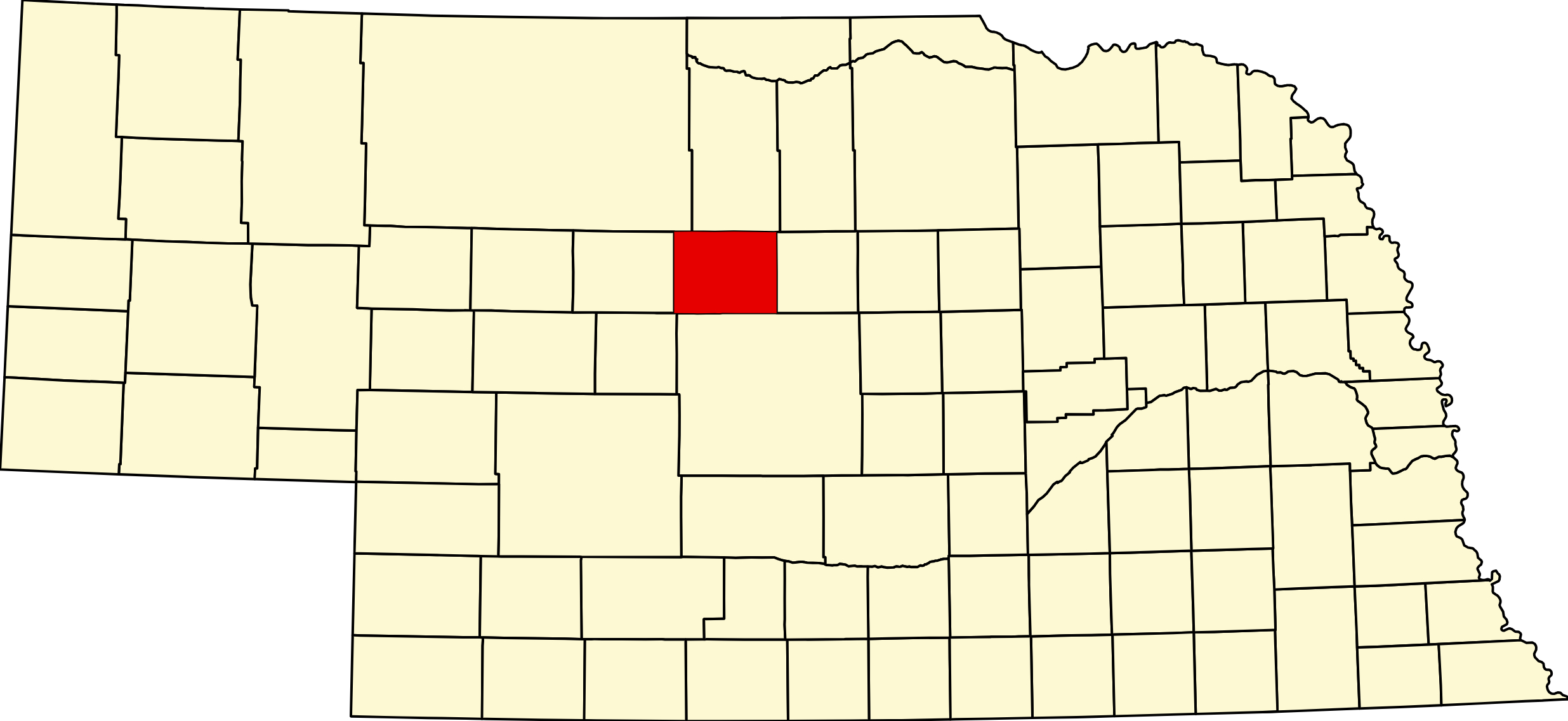
Blaine County, Nebraska
County Seat: Brewster
Founded: 1885
Named For: James G. Blaine, U.S. Secretary of State and statesman
License Plate Prefix: 86
Population: 431 (2020 census)
Area: 711 sq mi
History
Blaine County was established in 1885 and named after James G. Blaine, a prominent national political figure. Settlement in the region was shaped by the challenges of the Sandhills environment, where ranching proved far more sustainable than farming. Brewster, founded in the late 19th century, became the county seat and remains one of the smallest county seats in the United States.
The county’s history is deeply tied to cattle ranching, frontier homesteading, and the development of small, close‑knit communities across the Sandhills. Generations of ranching families have maintained the area’s traditions for more than a century.
Geography
Location: Central Sandhills region of Nebraska
Landscape: Sandhills dunes, rolling prairie, grasslands, and extensive ranchland
Adjacent Counties:
- Brown County (north)
- Rock County (northeast)
- Holt County (east)
- Loup County (south)
- Thomas County (west)
- Cherry County (northwest)
Culture & Landmarks
- Brewster Community Sites – Historic buildings and local landmarks tied to early settlement.
- Sandhills Prairie – One of the most intact grassland ecosystems in North America.
- Middle Loup River Region – Scenic corridor supporting wildlife and ranching.
Notable Communities
- Brewster – County seat and primary community.
- Dunning – Village located along the Middle Loup River.
Events & Attractions
- Blaine County Fair – Rodeo events, livestock shows, and community gatherings.
- Sandhills Ranching Heritage – Local events celebrating the region’s agricultural traditions.
- Outdoor Recreation – Wildlife viewing, scenic drives, and river‑valley exploration.
Living in Blaine County
Blaine County offers a quiet, rural lifestyle centered around ranching, open landscapes, and strong community ties. Brewster and Dunning provide essential services, while the county’s vast ranchlands define its character. Residents value the area’s peaceful pace, natural beauty, and deep connection to Nebraska’s Sandhills heritage.
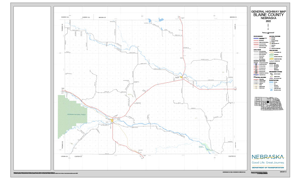
Blaine County Cameras
Outdoors — Camping, RV, Hunting & Fishing
The honest answer on camping: there is no established public campground in Blaine County. Not at Brewster, not at Dunning. No dump station is confirmed anywhere in the county either. What Blaine County has is the Sandhills Journey National Scenic Byway, a share of the Nebraska National Forest, prime prairie-grouse range, and three rivers.
Nearest camping, for planning purposes:
- Bessey Recreation Complex, Halsey, Thomas County — roughly 44 to 48 sites, about half with electric, seasonal flush toilets, showers and water, vault toilets year round. This is the practical basecamp for Blaine County.
- Sandhill River Trips Camping, south of Thedford (Thomas County), about 26 miles — four large pull-through sites with water and electric, plus a cabin.
- Cuzn Eddyz Campground, Merna (Custer County), about 30 miles — 19 sites, 17 full hookup.
- Hidden Valley Campground near Arnold (Custer County), about 29 miles — water, electric, sewer.
- Arnold Recreation Area (Custer County), about 28 miles — 29 primitive sites.
Nebraska National Forest in Blaine County. The Bessey Ranger District covers about 90,000 acres across Thomas and Blaine counties, with roughly ten thousand acres of it on the Blaine side. Blaine County holds forest land but no forest campground — the developed complex is at Halsey in Thomas County. Forest land here is open to public hunting under Forest Service rules.
Fire note: Stage 1 fire restrictions are in effect across all Nebraska National Forests and Grasslands under Forest Order 02-07-00-26-12, effective 18 July 2026. Verify current status before you plan a campfire — the Supervisor’s Office is (308) 432-0300. Camping in any one ranger district is limited to 14 nonconsecutive nights in a 30-day period.
Rivers. Dunning sits precisely at the confluence of the Middle Loup, coming in from the north, and the Dismal, coming in from the south. The North Loup runs at Brewster. USGS keeps real-time stream gauges on the Middle Loup at Dunning and the North Loup at Brewster.
Fishing. The North Loup holds brown and rainbow trout upstream and carp and channel catfish downstream, but no public access point is published in Blaine County — the nearest is Kent Diversion Dam WMA in Loup County. Blaine County river frontage is private and requires permission. No public fishing listing exists for the Blaine reaches of the Middle Loup or the Dismal.
Paddling closure: Game and Parks reports the Dismal River between the Seneca and Jameson bridges is impassable due to downed trees, and the trip planner has been withdrawn for public safety. That reach is upstream of Blaine County, but it is the reason most Dismal float plans fall apart.
Hunting. Milburn Dam WMA — 672 acres on the Middle Loup, where the 1956 Milburn Diversion Dam also provides canoe and kayak access. Forest Service land adds public ground. Beyond that, Open Fields and Waters walk-in tracts — the Sandhills counties are well represented in the program, and the current-year Public Access Atlas is the tool to use. Blaine County is prime sharp-tailed grouse and greater prairie-chicken range, with mule and white-tailed deer and wild turkey in the river valleys.
The byway. The Sandhills Journey National Scenic Byway runs through Blaine County via Dunning — 272 miles of Highway 2 from Grand Island to Alliance, about four and a half hours end to end. Charles Kuralt called it one of the ten most beautiful highways in America. It is the single best reason to route an RV through the county.
Blaine County, Nebraska (Plate #86)
County Seat: Brewster | Region: Nebraska Sandhills | Population: ~478 | Area: ~714 sq mi
Blaine County is one of the least populated counties in Nebraska and the United States, set entirely within the Nebraska Sandhills. Its county seat, Brewster, has a population of fewer than 20 — making it one of the smallest county seats in the nation. The county's most notable landmark is the Nebraska National Forest, Bessey Division near Halsey — the largest hand-planted national forest in the US. The NE-2 Sandhills Highway connects the county's communities across rolling grass dunes, wetlands, and open ranch country.
Primary Highway: NE-2 (Sandhills Highway)
Towns: Brewster · Dunning · Halsey · Purdum · Dunsin
Adjacent Counties: Rock County (north) · Loup County (east) · Garfield County (southeast) · Custer County (south) · Thomas County (west) · Logan County (southwest)
Region: Nebraska Sandhills
Adjacent Counties: Rock County (north) · Loup County (east) · Garfield County (southeast) · Custer County (south) · Thomas County (west) · Logan County (southwest)
Vehicles registered in Blaine County carry license plate number 86. See what every Nebraska county number means.
Blaine County Businesses & Places
31 listings in Blaine County.
Click a category to see the businesses.
Stay (1)
- Sandhills Guest Ranch B&B — Guest Ranch, Brewster
Outdoors & Recreation (1)
- Milburn Dam WMA — Public Hunting Areas & WMAs, Nebraska
Places to Visit (3)
- Blaine County Historical Society — History & Heritage Museums, Brewster
- Hereford Crossroads Exhibit — Specialty Museums, Dunning
- Sandhills Heritage Museum — History & Heritage Museums, Dunning
Events & Venues (2)
- Blaine County Fair — County Fair, Dunning
- Blaine County Fairgrounds — Fairground, Dunning
Government & Resources (14)
- Blaine County Assessor — County Assessor, Brewster
- Blaine County Attorney's Office — County Attorney, Brewster
- Blaine County Clerk — County Clerk, Brewster
- Blaine County Court — County Court, Brewster
- Blaine County Courthouse — Court House, Brewster
- Blaine County Driver License Office — County Driver License, Brewster
- Blaine County Emergency Management — Emergency Management, Nebraska
- Blaine County Sheriff — County Sheriff, Brewster
- Blaine County Treasurer — County Treasurer, Brewster
- Blaine County Weed Superintendent — County Weed Control, Brewster
- Brewster Post Office — Post Office, Brewster
- Brewster Village Office — City Hall, Brewster
- Dunning City Police — Post Office, Dunning
- Dunning Village Office — City Hall, Dunning
Community & Faith (7)
- Brewster Cemetery — Brewster — Cemeteries, Brewster
- Congregational UCC — Brewster — Congregational Church, Brewster
- Dunning Cemetery — Dunning — Cemeteries, Dunning
- German Valley Cemetery — Brewster — Cemeteries, Brewster
- Hawley Flats Cemetery — Dunning — Cemeteries, Dunning
- Purdum Cemetery — Purdum — Cemeteries, Nebraska
- Purdum UCC — Purdum — Congregational Church, Nebraska
Education (2)
- High School at Dunning — High School, Dunning
- Sandhills Public Schools — School District (K-12 / General), Dunning
Utilities (1)
- Village of Dunning — Water Utility / District, Dunning