
Homestead Trail: Lincoln to Beatrice on a Former Railroad
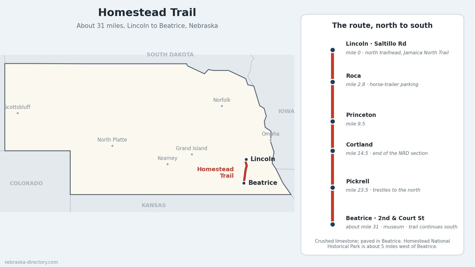
The Homestead Trail is a rail trail of about 31 miles running south from the edge of Lincoln to Beatrice, through Roca, Princeton, Cortland and Pickrell. It follows a former Union Pacific branch line across farm country and creek valleys, with restored railroad trestles along the way, and ends in downtown Beatrice a few miles from Homestead National Historical Park, the trail's namesake.
Current status: In early October 2026 the Lower Platte South Natural Resources District closed all of its trails, including its section of the Homestead Trail, because of flooding. Check the district's website before you go, and do not cross barricades.
Trail at a Glance
- Length: About 31 miles, from half a mile south of Saltillo Road in Lincoln to 2nd and Court streets in Beatrice.
- Surface: Crushed limestone, paved inside Beatrice.
- Uses: Biking, walking, running, cross-country skiing and wildlife watching. Horses are allowed on the limestone. No motor vehicles, camping, alcohol or hunting; pets must be leashed.
- Fees: None.
- Counties: Lancaster County and Gage County.
- Managed by: The Lower Platte South NRD (the 13 miles from Lincoln to Cortland) and the City of Beatrice (the southern section).
Towns Along the Trail, North to South
- Lincoln — the trail starts where the city's Jamaica North Trail ends, south of Saltillo Road.
- Roca — about 3 miles south, with trailer parking for horse riders.
- Princeton — about 9.5 miles.
- Cortland — about 14.5 miles; street parking.
- Pickrell — about 23.5 miles; a parking lot off West Pickrell Road.
- Beatrice — the south end at 2nd and Court streets, with parking and a restroom.
Trailheads and Parking
North trailhead: Saltillo Road, about a mile east of US 77 (listed as 2000 Saltillo Rd., Roca). Roca: parking with room for horse trailers. Cortland: street parking. Pickrell: lot off West Pickrell Road. Beatrice: 2nd and Court streets, across from Homestead Trailhead Park and next to the Gage County Historical Society & Museum, which has bike racks.
What You'll See
Open fields, shelterbelts and creek crossings, with restored wooden trestles on the stretch between Cortland and Pickrell, including crossings of Indian Creek. Volunteers decked 12 of the bridges when the northern section was built. In Beatrice the trail passes the 1906 Burlington depot that now houses the county museum, and the city's StoryWalk lines the trail on 2nd Street between Ella and Grant streets.
Connections
- North: the Jamaica North Trail into Lincoln, with links to Wilderness Park, the Salt Creek Levee Trail and the rest of Lincoln's trail network.
- South: the Chief Standing Bear Trail, about 37 miles from Beatrice to the Kansas line, where it continues as the Blue River Rail Trail to Marysville, Kansas.
- Beatrice: more than 10 miles of city trails, with parking at Riverside Park, Big Blue Water Park and Hannibal Park.
- Homestead National Historical Park: about 5 miles west of downtown Beatrice on Nebraska Highway 4. A trail link to the park is planned but not built; the park's own trails are for walking only, no bikes.
History Along the Trail
The line began as the Omaha & Republican Valley Railroad's branch between Lincoln and Beatrice, laid out in 1884 and later part of the Union Pacific. Union Pacific filed to abandon the corridor in 1999. In 2002 the City of Beatrice, Lancaster County and the Nebraska Trails Foundation bought it under federal rail-banking. The Lower Platte South NRD opened its section in November 2007, and the last gap, the 9 miles from Cortland to Pickrell, was finished in summer 2012.
The trail takes its name from the Homestead Act of 1862, which opened western land to settlers. Daniel Freeman's claim near Beatrice, said to be one of the first filed under the act, is preserved at Homestead National Historical Park, renamed from Homestead National Monument in 2021.
Nearby Places
- Homestead National Historical Park — Heritage Center and Freeman School, 8523 W. State Hwy. 4, Beatrice; free admission
- Gage County Historical Society & Museum — in the 1906 Burlington depot at the trail's south end
- Gage County Courthouse — the 1892 courthouse in downtown Beatrice
- Chautauqua Park — Beatrice city park and campground
Related Trails and Corridors
- Chief Standing Bear Trail — continues south from Beatrice
- US Highway 77 runs alongside the trail from Lincoln to Beatrice
- US Highway 136 and Nebraska Highway 4 — through Beatrice
- ← All Nebraska Trails