Municipal / General Aviation Airport

Displaying listings from all locations.

Use the fields below to filter listings for a particular country, city, or state. Start by selecting the top most region, the other fields will be automatically updated to show available locations.

Use the Clear Filter button if you want to start over.

Average Rating
(More feedback needed)
Short Description

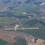
Crete Municipal Airport (FAA code CEK) is a city-owned airport about 2 miles east of Crete with a paved, lighted runway of about 4,200 feet and a 3,400-foot turf runway. 100LL and Jet A fuel are available.


Address
Crete Municipal Airport
2429 County Road F (East 13th Street)
Crete, NE
68333
State
Nebraska
Country
USA
County
Saline County
Town
Crete
Average Rating
(More feedback needed)
Short Description

Public general aviation airport serving Curtis and Frontier County in southwest Nebraska. FAA: 47V.


Address
Curtis Municipal Airport
Curtis, NE
69025
State
Nebraska
Country
USA
County
Frontier County
Town
Curtis
Average Rating
(More feedback needed)
Short Description

Public general aviation airport serving David City and Butler County. FAA: 93Y.


Address
David City Municipal Airport
David City, NE
68632
State
Nebraska
Country
USA
County
Butler County
Town
David City
Average Rating
(More feedback needed)
Short Description

Public general aviation airport serving Ord and Valley County in central Nebraska. Named for WWII aviator and Nebraska native Evelyn Sharp. FAA: ODX / KODX.


Address
Evelyn Sharp Field
81385 Hwy 11
Ord, NE
68862
State
Nebraska
Country
USA
County
Valley County
Town
Ord
Average Rating
(More feedback needed)
Short Description

Fairbury Municipal Airport (FAA identifier FBY) is 3 miles northeast of town.


Address
Fairbury Municipal Airport
Fairbury, NE
68352
State
Nebraska
Country
USA
County
Jefferson County
Town
Fairbury
Average Rating
(More feedback needed)
Short Description

Public general aviation airfield serving Fairmont and Fillmore County. FAA: FMZ / KFMZ.


Address
Fairmont State Airfield
Fairmont, NE
68354
State
Nebraska
Country
USA
County
Fillmore County
Town
Fairmont
Average Rating
(More feedback needed)
Short Description

Farington Field (FAA code K01) is Auburn's public-use airport, owned by the city and about 3 miles east of town.


Address
Auburn Municipal Airport (Farington Field)
Auburn, NE
68305
State
Nebraska
Country
USA
County
Nemaha County
Town
Auburn
Average Rating
(More feedback needed)
Short Description

Public general aviation airport serving the Fremont and Dodge County area. 6,350 ft main runway capable of handling corporate jets. Home to approximately 50 based aircraft and a local Civil Air Patrol chapter. Operated by the City of Fremont; fixed-base operator is Fremont Aviation.


Address
Fremont Municipal Airport
1777 W 23rd St
Fremont, NE
68025
Listing Tags
State
Nebraska
Country
USA
County
Dodge County
Town
Fremont
Average Rating
(More feedback needed)
Short Description

Public general aviation airport serving Oshkosh and Garden County (King Rhiley Field) in the western Sandhills. FAA: OKS / KOKS.


Address
Garden County Airport — Oshkosh
Oshkosh, NE
69154
State
Nebraska
Country
USA
County
Garden County
Town
Oshkosh
Average Rating
(More feedback needed)
Short Description

Public-use general aviation airport serving Genoa in Nance County. FAA: 97Y.


Address
Genoa Municipal Airport
Genoa, NE
68640
State
Nebraska
Country
USA
County
Nance County
Town
Genoa
Average Rating
(More feedback needed)
Short Description

Gordon Municipal Airport (FAA identifier GRN) is 1 mile east of Gordon and is owned by the Gordon Airport Authority.


Address
Gordon Municipal Airport
About 1 mi east of town on US 20
Gordon, NE
69343
State
Nebraska
Country
USA
County
Sheridan County
Town
Gordon
Average Rating
(More feedback needed)
Short Description

Gothenburg Municipal Airport (Quinn Field) is about 1 mile east of Gothenburg.


Address
Gothenburg Municipal Airport (Quinn Field)
Gothenburg, NE
69138
State
Nebraska
Country
USA
County
Dawson County
Town
Gothenburg
Average Rating
(More feedback needed)
Short Description

Public general aviation airport serving Hyannis and Grant County in the Nebraska Sandhills. FAA: 1V2.


Address
Grant County Airport — Hyannis
Hyannis, NE
69350
State
Nebraska
Country
USA
County
Grant County
Town
Hyannis
Average Rating
(More feedback needed)
Short Description

Grant Municipal Airport (FAA identifier GGF) is 2 miles north of Grant and is owned by the City of Grant.


Address
Grant Municipal Airport
Grant, NE
69140
State
Nebraska
Country
USA
County
Perkins County
Town
Grant
Average Rating
(More feedback needed)
Short Description

Harlan County Lake Seaplane Base, FAA identifier H63, is a public seaplane base on Harlan County Lake about 6 miles southwest of Alma, owned by the US Army Corps of Engineers.


Address
Harlan County Lake Seaplane Base
70788 Corps Rd A
Republican City, NE
68920
State
Nebraska
Country
USA
County
Harlan County
Town
Alma
Hartington Nebraska Airport
Average Rating
(More feedback needed)
Short Description

Hartington Municipal Airport, Bud Becker Field, FAA code 0B4, is about 2 miles southeast of town at an elevation of 1,388 feet.


Address
Hartington Municipal Airport
56395 881st Rd
Hartington, NE
68739
State
Nebraska
Country
USA
County
Cedar County
Town
Hartington
Average Rating
(More feedback needed)
Listing Title
Short Description

Public general aviation airfield serving Harvard and Clay County. FAA: 08K.


Address
Harvard State Airport
Harvard, NE
68944
State
Nebraska
Country
USA
County
Clay County
Town
Harvard
Average Rating
(More feedback needed)
Short Description

Public general aviation airport serving Hastings and Adams County in south-central Nebraska. FAA: HSI / KHSI.


Address
Hastings Municipal Airport
3300 West 12th Street
Hastings, NE
68901
State
Nebraska
Country
USA
County
Adams County
Town
Hastings
Average Rating
(More feedback needed)
Short Description

Public-use general aviation airport serving Hay Springs in Sheridan County. FAA: 4V6.


Address
Hay Springs Municipal Airport
Hay Springs, NE
69347
State
Nebraska
Country
USA
County
Sheridan County
Town
Hay Springs
Average Rating
(More feedback needed)
Short Description

Hebron Municipal Airport, FAA code HJH, is 1 mile south of Hebron at an elevation of 1,468 feet, owned by the Hebron Airport Authority.


Address
Hebron Municipal Airport
Hebron, NE
68370
State
Nebraska
Country
USA
County
Thayer County
Town
Hebron